404
Oops!, that page can’t be found.
There are other options that might interest you below
Oops!, that page can’t be found.
There are other options that might interest you below
Search Results
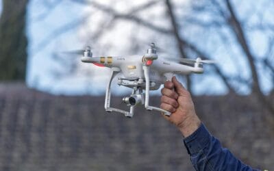
Advancements in Drone Technology for Remote Sensing
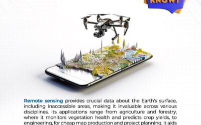
Drones, also known as unmanned aerial vehicles (UAVs), have become a game-changer in the field of remote sensing with the use of specialized sensors like LiDAR (Light Detection and Ranging) and hyperspectral cameras. These advancements are transforming remote sensing...

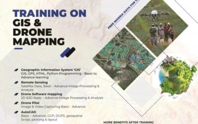
Top Companies for Drone, GIS and Survey training in Nigeria
In this blog post, we would be discussing about where you can professionally learn about Drones, GIS, and Surveying in Nigeria. Let’s briefly highlight the three major aforementioned subjects stated above before we proceed any further. What is a drone? A drone is an...
Top Places for GIS Analysis in Nigeria
GIS ANALYSIS IN NIGERIA What is GIS analysis? GIS (Geographic Information System) analysis is a powerful tool that helps us understand and interpret spatial data. It's like having a superpower that allows us to visualize and analyze complex relationships between...
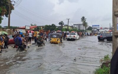
Understanding Flood Risk in Lagos
Introduction Flooding is a significant environmental and socioeconomic issue affecting many parts of the world. In coastal cities like Lagos, Nigeria, the risk of flooding is exacerbated by various factors, including geographical location, urbanization, and climate...
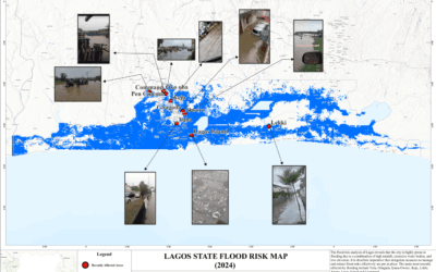
Understanding Flood Risk in Lagos: Causes, Impact, and Solutions
Introduction Flooding is a significant environmental and socioeconomic issue affecting many parts of the world. In coastal cities like Lagos, Nigeria, the risk of flooding is exacerbated by various factors, including geographical location, urbanization, and climate...

Tips for Calibrating Your Drone’s Compass and IMU
Calibration is essential because it establishes a baseline for your drone's internal sensors, such as the gyroscope, accelerometer, and compass. Calibrating the compass and IMU (Inertial Measurement Unit) on a drone helps to ensure that the drone's flight controls are...
Tips for Drone Calibration
Calibration is essential because it establishes a baseline for your drone's internal sensors, such as the gyroscope, accelerometer, and compass. Calibrating the compass and IMU (Inertial Measurement Unit) on a drone helps to ensure that the drone's flight controls are...

The Role of Geo-information in Urban Planning
Urban planning is a multifaceted field that requires a delicate balance between development and sustainability. One of the most critical tools in modern urban planning is geo-information, which encompasses geographical data and spatial information. This technology has...

Companies that sell affordable drones in Nigeria
What Is a Drone? Drones are small or medium-sized unmanned aerial vehicles (UAV). They're unique in that they can drive remotely and autonomously, and they're capable of maintaining a controlled, sustained level of flight. The drone system combines robotics...
CONTACT US