Search for the training you need
At Geoinfotech, we’re committed to supporting your training in geoinformatics and related technologies.
Whether you’re brand-new to ArcGIS, Drone, Surveying and Mapping or a seasoned GIS professional who wants to master the latest technology, we have resources to help you achieve your goals

Physical Training
At Geoinfotech we offer extensive hands-on practical training and field experience for individuals, group or for organizations. Register to explore our courses on Drone, GIS, Remote Sensing, GPS, Python development, advanced analysis tools, and many more.

Online Traning
Explore Geoinfotech's online training platform, at home or anywhere you are on Drone, GIS, Remote Sensing, GPS, Python development, advanced analysis tools, and many more. We have developed our online platform to be responsive for easy navigation and professionally recorded for better understanding.
No Results Found
The page you requested could not be found. Try refining your search, or use the navigation above to locate the post.
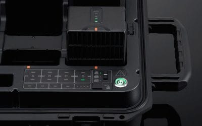
Power Beyond Limits: Why the TB65 Battery is the Lifeline Your M350 RTK Needs
If you own the DJI Matrice 350 RTK, you already know you're working with one of the most powerful...
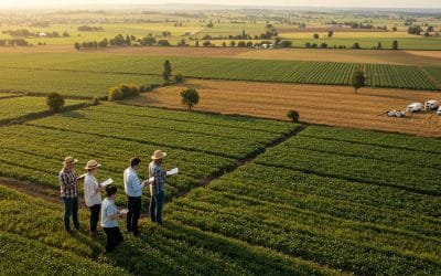
Remote Sensing in Agriculture: Beyond Crop Health to Food Security Planning
In the age of climate Variability and increasing global food demand, agriculture is no longer a...

DJI Mavic 3 Pro + RC Fly More Combo Price in Nigeria
DJI Mavic 3 Pro + RC Fly More Combo Price in Nigeria (2025) Searching for the best place to buy...
SERVICE LIST
We take your industry to the next level. Support Service Geoinfotech

Drone (Survey, Inspection, Surveillance, and Mapping)

Geographic Information System

Land Surveying

Remote Sensing and Satellite Mapping

Hydrographic Survey (Bathymetry)

Geophysical Survey

Training (Beginners to Advance / Professional)

GeoStore (Buy Products) Hardware / Software