Search for the training you need
At Geoinfotech, we’re committed to supporting your training in geoinformatics and related technologies.
Whether you’re brand-new to ArcGIS, Drone, Surveying and Mapping or a seasoned GIS professional who wants to master the latest technology, we have resources to help you achieve your goals

Physical Training
At Geoinfotech we offer extensive hands-on practical training and field experience for individuals, group or for organizations. Register to explore our courses on Drone, GIS, Remote Sensing, GPS, Python development, advanced analysis tools, and many more.

Online Traning
Explore Geoinfotech's online training platform, at home or anywhere you are on Drone, GIS, Remote Sensing, GPS, Python development, advanced analysis tools, and many more. We have developed our online platform to be responsive for easy navigation and professionally recorded for better understanding.
The food chain: will make trillions for better land management
Economy global 2030 food The global economy stands to gain nearly $6 trillion a year by 2030 from...
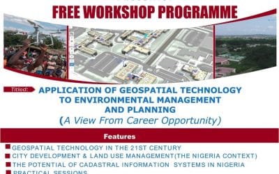
Free Workshop on Application of Geo-spatial Technology to Environmental Management and Planning
Free Workshop on Application of Geo-spatial Technology Free Workshop Programme Programme at...

Certified Training on GIS, RS, Drone Mapping and AutoCAD Training
Certified Training on GIS Professional Certified Training Certified Training on GIS Geoinfotech...

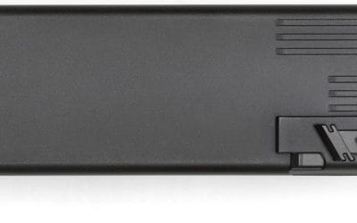
Maximize Your Missions with the DJI Mavic 3 Enterprise Battery Kit
If you’re operating the DJI Mavic 3 Enterprise, Thermal, or Multispectral, you know it’s a...

Soar to New Heights with the DJI Phantom 4 Drone
If you’re looking to capture breathtaking aerial footage or streamline professional tasks, the DJI...
Elevate Your Drone Game with the DJI Mavic 3 Intelligent Flight Battery
If you’re flying the DJI Mavic 3, you’re already equipped with a top-tier drone renowned for its...
SERVICE LIST
We take your industry to the next level. Support Service Geoinfotech

Drone (Survey, Inspection, Surveillance, and Mapping)

Geographic Information System

Land Surveying

Remote Sensing and Satellite Mapping

Hydrographic Survey (Bathymetry)

Geophysical Survey

Training (Beginners to Advance / Professional)

GeoStore (Buy Products) Hardware / Software