Search for the training you need
At Geoinfotech, we’re committed to supporting your training in geoinformatics and related technologies.
Whether you’re brand-new to ArcGIS, Drone, Surveying and Mapping or a seasoned GIS professional who wants to master the latest technology, we have resources to help you achieve your goals

Physical Training
At Geoinfotech we offer extensive hands-on practical training and field experience for individuals, group or for organizations. Register to explore our courses on Drone, GIS, Remote Sensing, GPS, Python development, advanced analysis tools, and many more.

Online Traning
Explore Geoinfotech's online training platform, at home or anywhere you are on Drone, GIS, Remote Sensing, GPS, Python development, advanced analysis tools, and many more. We have developed our online platform to be responsive for easy navigation and professionally recorded for better understanding.
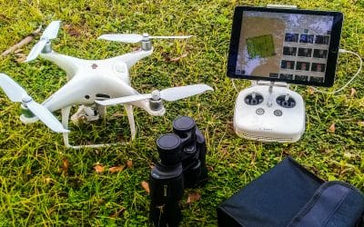
NCC issues new regulation for the use of UAV’s
Regulation drones Drones have found application in several areas that are contributing to the...
Safety tips to consider when flying drones
Things to consider when flying drones Before going to the field, make sure you charge up the...
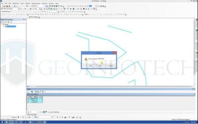
Auto-save in ArcGIS while editing
Download Script ARCGIS_AUTOSAVE At ArcGIS 10.3 for Desktop, the ArcGIS Pro application can be set...

DJI Mavic 3 Enterprise Thermal Price in Nigeria: Your Ultimate Guide
The DJI Mavic 3 Enterprise Thermal (M3T) is setting new standards for compact, multi-sensor...

DJI Mavic 3 Enterprise: Precision Drone Mapping at Its Best
Elevate your drone mapping projects with the DJI Mavic 3 Enterprise, a compact and powerful...

DJI Mavic 3 Classic: Precision Mapping from the Skies
Elevate your drone mapping projects with the DJI Mavic 3 Classic, a flagship drone designed for...
SERVICE LIST
We take your industry to the next level. Support Service Geoinfotech

Drone (Survey, Inspection, Surveillance, and Mapping)

Geographic Information System

Land Surveying

Remote Sensing and Satellite Mapping

Hydrographic Survey (Bathymetry)

Geophysical Survey

Training (Beginners to Advance / Professional)

GeoStore (Buy Products) Hardware / Software