Search for the training you need
At Geoinfotech, we’re committed to supporting your training in geoinformatics and related technologies.
Whether you’re brand-new to ArcGIS, Drone, Surveying and Mapping or a seasoned GIS professional who wants to master the latest technology, we have resources to help you achieve your goals

Physical Training
At Geoinfotech we offer extensive hands-on practical training and field experience for individuals, group or for organizations. Register to explore our courses on Drone, GIS, Remote Sensing, GPS, Python development, advanced analysis tools, and many more.

Online Traning
Explore Geoinfotech's online training platform, at home or anywhere you are on Drone, GIS, Remote Sensing, GPS, Python development, advanced analysis tools, and many more. We have developed our online platform to be responsive for easy navigation and professionally recorded for better understanding.
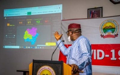
Research on how Fayemi Unveil the use of Geographic Information System in Covid 19
The use of Geographic information system [GIS] was introduced into the system based application...
GIS software used by professionals
GIS software are computer-based tools designed to capture, store, retrieve, manage, display and...
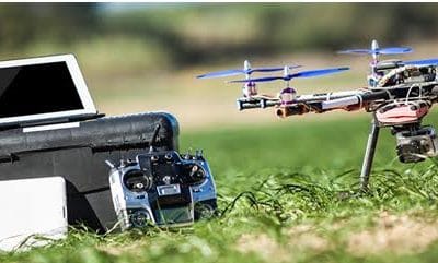
Overview of Drone Hardware components:
Drone Hardware components Many typical drones have two units: receiver and transmitter. The...
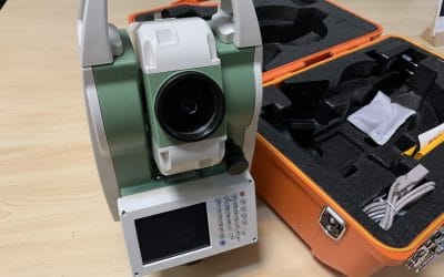
Elevate Your Surveying Game with the FOIF Total Station
Ready to transform your surveying projects in Nigeria? The FOIF Total Station, priced at a...
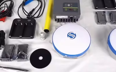
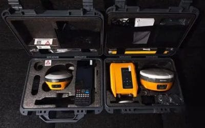
Ignite Precision with the Stonex S9II Base and Rover GNSS RTK Receiver
Ready to dominate Nigeria’s surveying landscape? The Stonex S9II Base and Rover GNSS RTK Receiver...
Boost Your Surveying with the HI-TARGET V200 Base and Rover GNSS RTK Receiver
For Nigeria’s surveyors, engineers, and geospatial professionals, the HI-TARGET V200 Base and...
SERVICE LIST
We take your industry to the next level. Support Service Geoinfotech

Drone (Survey, Inspection, Surveillance, and Mapping)

Geographic Information System

Land Surveying

Remote Sensing and Satellite Mapping

Hydrographic Survey (Bathymetry)

Geophysical Survey

Training (Beginners to Advance / Professional)

GeoStore (Buy Products) Hardware / Software