Search for the training you need
At Geoinfotech, we’re committed to supporting your training in geoinformatics and related technologies.
Whether you’re brand-new to ArcGIS, Drone, Surveying and Mapping or a seasoned GIS professional who wants to master the latest technology, we have resources to help you achieve your goals

Physical Training
At Geoinfotech we offer extensive hands-on practical training and field experience for individuals, group or for organizations. Register to explore our courses on Drone, GIS, Remote Sensing, GPS, Python development, advanced analysis tools, and many more.

Online Traning
Explore Geoinfotech's online training platform, at home or anywhere you are on Drone, GIS, Remote Sensing, GPS, Python development, advanced analysis tools, and many more. We have developed our online platform to be responsive for easy navigation and professionally recorded for better understanding.

ESRI AND AFROCHAMPIONS LAUNCH PARTNERSHIP TO PROMOTE GIS IN AFRICA
Esri, the global leader in location intelligence, today announced a joint initiative...

Makoko-Transit from a slum with a new mapping project.
Makoko waterfront slum In recent years, concerned authorities responsible for safety and security...

Helicopter crashed into a residential building
A helicopter said to operated by Quorom avaition coming from PortHarcout crashed into a...
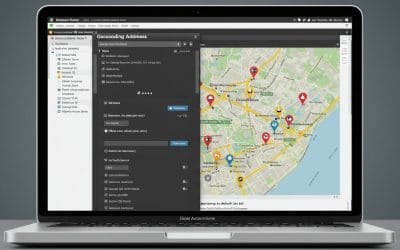
How to Geocode Addresses Using QGIS
In today’s data-driven world, geocoding is an essential skill for any GIS professional. Geocoding...

How to Create a Road Network
Map of Ikeja in Lagos State Using ArcGIS Pro and OpenStreetMap Data Mapping a city’s road network...
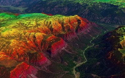
Understanding Remote Sensing
Introduction: Seeing the Unseen Have you ever wondered how your favorite weather app seems to know...
SERVICE LIST
We take your industry to the next level. Support Service Geoinfotech

Drone (Survey, Inspection, Surveillance, and Mapping)

Geographic Information System

Land Surveying

Remote Sensing and Satellite Mapping

Hydrographic Survey (Bathymetry)

Geophysical Survey

Training (Beginners to Advance / Professional)

GeoStore (Buy Products) Hardware / Software