Search for the training you need
At Geoinfotech, we’re committed to supporting your training in geoinformatics and related technologies.
Whether you’re brand-new to ArcGIS, Drone, Surveying and Mapping or a seasoned GIS professional who wants to master the latest technology, we have resources to help you achieve your goals

Physical Training
At Geoinfotech we offer extensive hands-on practical training and field experience for individuals, group or for organizations. Register to explore our courses on Drone, GIS, Remote Sensing, GPS, Python development, advanced analysis tools, and many more.

Online Traning
Explore Geoinfotech's online training platform, at home or anywhere you are on Drone, GIS, Remote Sensing, GPS, Python development, advanced analysis tools, and many more. We have developed our online platform to be responsive for easy navigation and professionally recorded for better understanding.
Experts urged to embrace GIS technology
Experts urged to embrace GIS technology. Experts have urged estate surveyors and valuers to...

Akwa ibom Government takes Sustainable Agriculture to Hinterlands.
AkwaIbom Government Agric business As a follow-up on the recent training of agricbusiness...
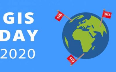
GIS Day 2020
GIS Day 2020 GIS Day: Initiating an innovative technology that merges disciplines, filters...

OPTIMIZING AGRICULTURAL PRODUCTIVITY; LAND USE MAPPING FOR MODERN FARMS
In the evolving landscape of global agriculture, optimizing productivity is a continuous pursuit,...

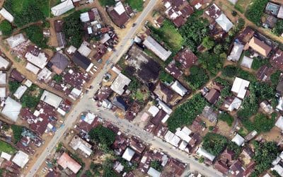
HOW GEOSPATIAL TECHNOLOGY SUPPORTS DISASTER RESPONSE DURING THE 2025 MOKWA FLOODS
In May 2025, the town of Mokwa in Niger State, Nigeria, experienced one of the most catastrophic...
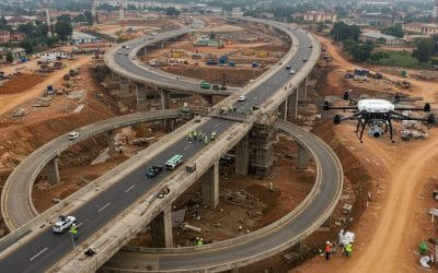
How Drone Technology is Revolutionizing Construction and Infrastructure in Nigeria
The construction and infrastructure sectors in Nigeria are booming—but so are the challenges:...
SERVICE LIST
We take your industry to the next level. Support Service Geoinfotech

Drone (Survey, Inspection, Surveillance, and Mapping)

Geographic Information System

Land Surveying

Remote Sensing and Satellite Mapping

Hydrographic Survey (Bathymetry)

Geophysical Survey

Training (Beginners to Advance / Professional)

GeoStore (Buy Products) Hardware / Software