Search for the training you need
At Geoinfotech, we’re committed to supporting your training in geoinformatics and related technologies.
Whether you’re brand-new to ArcGIS, Drone, Surveying and Mapping or a seasoned GIS professional who wants to master the latest technology, we have resources to help you achieve your goals

Physical Training
At Geoinfotech we offer extensive hands-on practical training and field experience for individuals, group or for organizations. Register to explore our courses on Drone, GIS, Remote Sensing, GPS, Python development, advanced analysis tools, and many more.

Online Traning
Explore Geoinfotech's online training platform, at home or anywhere you are on Drone, GIS, Remote Sensing, GPS, Python development, advanced analysis tools, and many more. We have developed our online platform to be responsive for easy navigation and professionally recorded for better understanding.

Long range drone will Enhance Security, Boost Economic Growth
Drone technology is commonly deployed in our everyday lives, from taking selfies to the...

A done deal, as Kaduna State Signs MoU with Zipline to Deliver Vaccines with Drones
Zipline, an American company with a specialization in delivering medical products recently signed...

Laptop thief tracked with my drone, says Lagos-based videographer
The fact that stealing appears to be on the rise throughout the country is no more news. And...
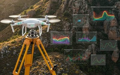
The Interrelationship of Surveying, Geospatial Analysis, and Drone Technology.
In an era where location data has become central to decision-making, infrastructure planning, and...
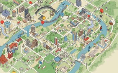
Topology in GIS: Beyond Geometry — Understanding Spatial Relationships
In the world of Geographic Information Systems (GIS), geometry may be the star of the show—but...
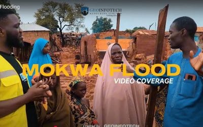
What Happened in Mokwa: A Simple Explanation
A Summary of the Flooding Incident at Mokwa On May 29, 2024, a devastating flash flood struck...
SERVICE LIST
We take your industry to the next level. Support Service Geoinfotech

Drone (Survey, Inspection, Surveillance, and Mapping)

Geographic Information System

Land Surveying

Remote Sensing and Satellite Mapping

Hydrographic Survey (Bathymetry)

Geophysical Survey

Training (Beginners to Advance / Professional)

GeoStore (Buy Products) Hardware / Software