Search for the training you need
At Geoinfotech, we’re committed to supporting your training in geoinformatics and related technologies.
Whether you’re brand-new to ArcGIS, Drone, Surveying and Mapping or a seasoned GIS professional who wants to master the latest technology, we have resources to help you achieve your goals

Physical Training
At Geoinfotech we offer extensive hands-on practical training and field experience for individuals, group or for organizations. Register to explore our courses on Drone, GIS, Remote Sensing, GPS, Python development, advanced analysis tools, and many more.

Online Traning
Explore Geoinfotech's online training platform, at home or anywhere you are on Drone, GIS, Remote Sensing, GPS, Python development, advanced analysis tools, and many more. We have developed our online platform to be responsive for easy navigation and professionally recorded for better understanding.

Nigerian Navy Bridging Maritime Security Gaps: The Last Five Years
The Nigerian Navy has In line with its statutory mandate, in the past five years under the...

Nigeria priortising innovation, technology investments in agriculture
Nigeria is prioritizing innovation and technology investments in agriculture in order to transform...
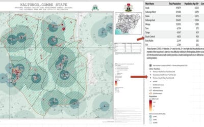
Geospatial technology aiding Nigeria’s COVID-19 vaccine roll-out
In the lead up to Nigeria receiving the first batch of 16 million doses of the Oxford-AstraZeneca...

The Power of Spatial Thinking: How GIS Drives Smart Decision-Making Across Sectors
In a world overflowing with data and facing increasingly complex challenges — from climate change...
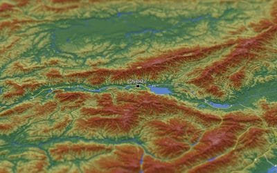
Working with Raster Data in QGIS – Series 5
Raster data forms a core part of spatial analysis from satellite imagery to digital elevation...

The Case for Expanding Your GIS Toolbox Beyond ArcGIS
In the world of Geographic Information Systems (GIS), ArcGIS has long been the industry giant —...
SERVICE LIST
We take your industry to the next level. Support Service Geoinfotech

Drone (Survey, Inspection, Surveillance, and Mapping)

Geographic Information System

Land Surveying

Remote Sensing and Satellite Mapping

Hydrographic Survey (Bathymetry)

Geophysical Survey

Training (Beginners to Advance / Professional)

GeoStore (Buy Products) Hardware / Software