
Search for the training you need
At Geoinfotech, we’re committed to supporting your training in geoinformatics and related technologies.
Whether you’re brand-new to ArcGIS, Drone, Surveying and Mapping or a seasoned GIS professional who wants to master the latest technology, we have resources to help you achieve your goals

Physical Training
At Geoinfotech we offer extensive hands-on practical training and field experience for individuals, group or for organizations. Register to explore our courses on Drone, GIS, Remote Sensing, GPS, Python development, advanced analysis tools, and many more.

Online Training
Explore Geoinfotech's online training platform, at home or anywhere you are on Drone, GIS, Remote Sensing, GPS, Python development, advanced analysis tools, and many more. We have developed our online platform to be responsive for easy navigation and professionally recorded for better understanding.
SERVICE LIST
We take your industry to the next level. Support Service Geoinfotech

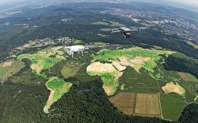
Drone (Survey, Inspection, Surveillance, and Mapping)

Geographic Information System

Land Surveying

Remote Sensing and Satellite Mapping

Hydrographic Survey (Bathymetry)

Geophysical Survey

Training (Beginners to Advance / Professional)

GeoStore (Buy Products) Hardware / Software

NIS encourages the use of technology in preventing collapse
NIS encourages the use of technology in preventing collapse According to the Nigerian Institution...
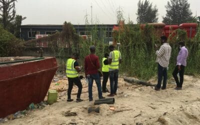
How property for valuation is prepared by our land surveyors
In order to achieve seamless results, property for valuation is prepared by our land surveyors to...

Geoinfotech Drone Mapping, Surveying and Inspection Services
Geoinfotech Drone Mapping, Surveying and Inspection Services Geoinfotech Resource Limited offers a...
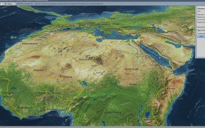
Georeferencing and Digitizing in QGIS – Series 4
Many valuable maps and spatial records still exist as scanned images. Examples are historical...
GIS: Your Secret Weapon Against Climate Change
The alarm bells are ringing louder than ever. From scorching heatwaves and devastating floods to...

ARCGIS MODELBUILDER: Automating Spatial Workflows
Model Builder is a visual programming tool in ArcGIS Pro (and earlier ArcMap) that lets GIS...