

Search for the training you need
At Geoinfotech, we’re committed to supporting your training in geoinformatics and related technologies.
Whether you’re brand-new to ArcGIS, Drone, Surveying and Mapping or a seasoned GIS professional who wants to master the latest technology, we have resources to help you achieve your goals

Physical Training
At Geoinfotech we offer extensive hands-on practical training and field experience for individuals, group or for organizations. Register to explore our courses on Drone, GIS, Remote Sensing, GPS, Python development, advanced analysis tools, and many more.

Online Training
Explore Geoinfotech's online training platform, at home or anywhere you are on Drone, GIS, Remote Sensing, GPS, Python development, advanced analysis tools, and many more. We have developed our online platform to be responsive for easy navigation and professionally recorded for better understanding.
SERVICE LIST
We take your industry to the next level. Support Service Geoinfotech

Drone (Survey, Inspection, Surveillance, and Mapping)

Geographic Information System

Land Surveying

Remote Sensing and Satellite Mapping

Hydrographic Survey (Bathymetry)

Geophysical Survey

Training (Beginners to Advance / Professional)

GeoStore (Buy Products) Hardware / Software

False-Color Lunar Topography: Visualizing the Southeastern Moon
Looking Beyond the Moon's Familiar Surface The Moon remains one of the most recognizable objects...
Willkommen im Zizobet Casino – Ihr Portal zur Welt des Online-Glücksspiels
Entdecken Sie das Zizobet Casino mit einer Vielzahl von Spielen, großzügigen Boni und einer...
Gratis Freebet Uden Indbetaling – En Guide til Gambling Entusiaster
Opdag hvordan du kan få gratis freebet uden indbetaling og trivsel i online gambling. Læs videre...

GIS Training Certificate in Nigeria
GIS Training Certificate in Nigeria Enter the growing GIS sector by developing your skills in...
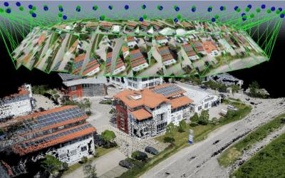
No 1 Drone Companies in Nigeria
Drone companies in Nigeria Drone companies in Nigeria Contact us Geoinfotech is a leading provider...

How to download Satellite images (Landsat, Sentinel and DEM)
How to download Satellite images How to download Satellite image from usgs 2. Download...