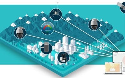
Drone services in Lagos have evolved significantly, moving far beyond aerial photography; they now...


YOU MAY ALSO LIKE...
Drone services in Lagos have evolved significantly, moving far beyond aerial photography; they now...

Drones are no longer just for photography enthusiasts—they have become vital tools in agriculture,...
Field-based data collection has always been a crucial component of environmental studies, urban...
What is GIS? Geographic Information Systems (GIS) have become one of the most powerful tools of...
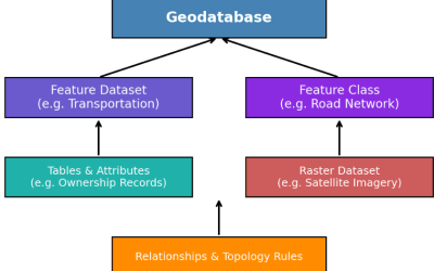
The increasing demand for geospatial information in Nigeria has transformed how data is collected,...
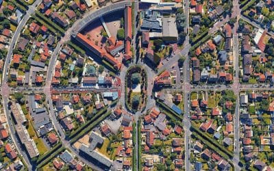
Building Lagos with Confidence Lagos is Africa’s fastest-growing city. Every day, new estates,...