404
Oops!, that page can’t be found.
There are other options that might interest you below
Oops!, that page can’t be found.
There are other options that might interest you below
Search Results
Land Surveyors and Surveying Position in Nigeria
Land surveyor surveyors There are many places in Nigeria where you can use the name "survey" or "Surveyor" for work. This includes banks, manufacturing companies, schools, universities, medical institutions, research companies, government agencies, etc. In most cases,...
Land Surveying Jobs/Career in Nigeria
LandLand Surveying Jobs/Career in Nigeria Surveyors make precise measurements to determine the boundaries of the attributes of land. Filming includes fieldwork and office work. When working outdoors, surveyors can stand for a long time and often walk long distances,...
Process Needed to Complete GIS Analysis
This is a five-step process to complete a GIS analysis project using ArcMap (the same analysis can be easily done in ArcGIS Pro). The five steps in the analysis process: develop a problem search and prepare the data. Select analysis methods and tools to perform...
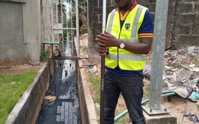
Land Survey in Nigeria
At Geoinfotech, the services we provide combine professional staff, advanced equipment, to ensure that we provide comprehensive land survey in Nigeria, topographic survey, engineering survey, hydrological survey, cadastral survey and control survey software. If you...

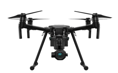
Geoinfotech Drone Surveying
Drone surveying is a new technology used for surveying. At Geoinfotech, we use Leading Drone to quickly and economically collect, analyze and map Nigeria’s aviation data, alongside other countries and strive to meet customer needs by changing the real world....
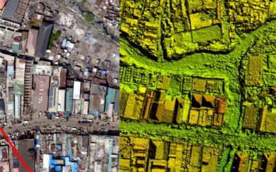
What’s new about 3DSurvey.
What's new about 3DSurvey 3D survey is a Process that involves the passage from the real object to its representation, which leads to the definition of graphic models through a cultural process aimed at a critical reading of the object and its description 3D and 2D...

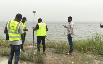
Land Surveyors in Nigeria
Geoinfotech Surveying or Surveyors Services is all about the science and profession of determining the positions of points on the surface of the earth and measuring the distances, directions, angles, and elevations between them. Professional surveys are the only...

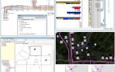
What’s new about QGIS
QGIS is a desktop geographic information system (GIS) application that supports viewing, editing, and analysis of geospatial data. QGIS functions as geographic information system (GIS) software, allowing users to analyze and edit spatial information, in addition to...
Drone Business in Lagos Abuja Nigeria
Geoinfotech Drone Surveying, Mapping, Inspection, or Surveillance company business in Lagos Abuja Nigeria is an innovative and cost-efficient way to collect aerial data on projects in surveying, construction, agriculture, energy, and more. Contact us for costing With...
CONTACT US