404
Oops!, that page can’t be found.
There are other options that might interest you below
Oops!, that page can’t be found.
There are other options that might interest you below
Search Results
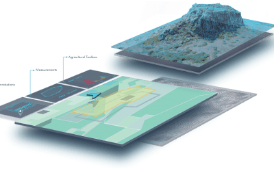
Application of GIS in Disaster Management
Application of GIS in Disaster Management Use of Geospatial Technologies in Collecting & Analysing Data in Real Time Natural disasters are dangerous events that occur as a result of natural processes on Earth. Floods, earthquakes, hurricanes/cyclones,...
Importance of GIS in Agriculture
Importance of GIS in Agriculture GIS which stands for Geographic Information System is a system that is used for acquiring, storing, analyzing, manipulating, and displaying data related to position on Earth’s Surface. GIS helps in vegetation management, soil...

ArcGIS Desktop and ArcGIS Pro Manual
ArcGIS Desktop and ArcGIS Pro Manual INTRODUCTION TO GIS GIS simply means Geographic Information System, this system consists of a set of tools that are used for collecting, storing, retrieving, transforming, and displaying spatial data from the real world for...

Use of GIS in Disaster Management
Use of GIS in Disaster Management GIS (Geographic Information System) has become a crucial tool in disaster management. It helps organizations respond quickly to disasters and better understand the extent of the damage, assess the impacts, and make informed...

How Gis is Used in Irrigation Water Management
How Gis is Used in Irrigation Water Management Irrigation is a practice that involves the artificial application of water to soil on land, through various systems of tubes, pumps, and sprays. Irrigation is typically employed in locations where rainfall is...
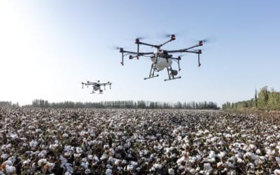
How GIS is Used in Agriculture
How GIS is Used in Agriculture The number of GIS applications in agriculture has exploded in recent years thanks to technological advancements. Let’s discuss some of the most popular current applications. Precision Agriculture Precision agriculture GIS software...
Cost to Buy Maps and Drones and GPS or GIS Software in Abuja
Cost to Buy Maps and Drones and GPS or GIS Software in Abuja Cost to Buy GIS tools in Abuja How can I buy a drone in Abuja? (Cost to Buy Maps and Drones and GPS or GIS Software in Abuja) 1. Learn About Different Types of Drones. Every hobby comes with an entirely new...

Cost to Buy Maps and Drones and GPS or GIS Software in Lagos
Cost to Buy Maps and Drones and GPS or GIS Software in Lagos How can I buy a drone in Lagos? (Cost to Buy Maps and Drones and GPS or GIS Software in Lagos) 1. Learn About Different Types of Drones. Every hobby comes with an entirely new vocabulary to learn 2....
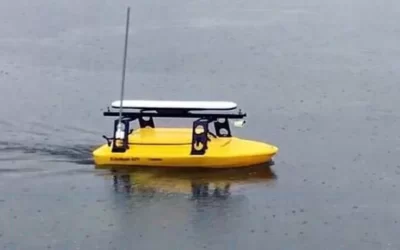
Bathymetry Aerial or Drone Services in Abuja
Bathymetry Aerial or Drone Services in Abuja Bathymetry measures the depth of water in oceans, rivers, or lakes. Bathymetric maps look a lot like topographic maps, which use lines to show the shape and elevation of land features. On topographic maps, the tubes...
CONTACT US