404
Oops!, that page can’t be found.
There are other options that might interest you below
Oops!, that page can’t be found.
There are other options that might interest you below
Search Results
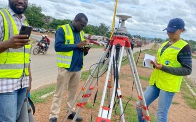
How Modern Land Surveying Guides Every Project in Lagos and Across Nigeria
If you’ve ever seen a new building rise, a road being constructed, or farmland divided for sale, a land surveyor was there before the first shovel touched the ground. In Nigeria, land surveying is the backbone of every successful project. The goal is straightforward:...
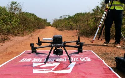
Drone Mapping and Survey in Nigeria
What is Drone Mapping and Survey & how is it used in Nigeria? Drone mapping involves using a drone equipped with a high-resolution camera to capture hundreds of overlapping photos from the air. These images are stitched together using specialized software to...
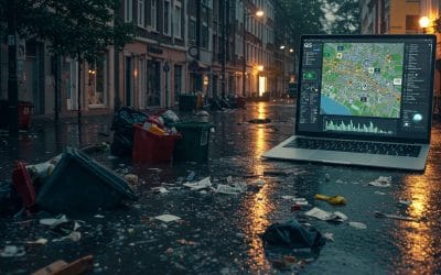
WASTE MANAGEMENT, URBAN FLOODING, AND THE HIDDEN ROLE OF GIS
In today’s rapidly urbanizing world, the challenges of managing solid waste and controlling urban flooding are intensifying—especially in developing regions where rapid population growth often outpaces infrastructure development. While waste management and flooding...

Training the Next Generation: Why Public Health Students Need GIS Skills
In the age of big data and global health challenges, public health professionals are increasingly being asked to do more than analyze spreadsheets — they must see the bigger picture, literally. Geographic Information Systems (GIS) are no longer niche tools; they’re...
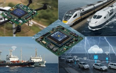
The Invisible Network: How GNSS Powers More Than Just Your Phone GPS
We've all been there: relying on our smartphones to navigate to a new restaurant, find the quickest route home, or even pinpoint a lost car in a sprawling parking lot. "Just use GPS," we say, almost instinctively. But what if we told you that the technology powering...

Enhancing Security in Nigeria with Drone Technology: A New Era of Surveillance
In a nation as dynamic and geographically diverse as Nigeria, ensuring security across rural, urban, and border regions remains a pressing challenge. From combating banditry in the North to addressing oil theft in the Niger Delta and monitoring urban crime in cities...
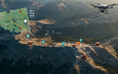
How GIS is Revolutionizing Search and Rescue (SAR) Missions
Using Spatial Intelligence to Save Lives in Real Time. In critical moments when disaster strikes—whether it's a hiker lost in the mountains, a plane gone off radar, or survivors trapped after an earthquake—every second counts. That's where Geographic Information...

The Power of Spatial Thinking: How GIS Drives Smart Decision-Making Across Sectors
In a world overflowing with data and facing increasingly complex challenges — from climate change and population growth to urban sprawl and supply chain disruptions — the most critical questions often start with one simple word: Where? Where should we build next?...
Working with Raster Data in QGIS – Series 5
Raster data forms a core part of spatial analysis from satellite imagery to digital elevation models (DEMs). In this part of the series, we’ll explore what raster data is, how to load it into QGIS, and how to perform basic analysis and visualization. What is Raster...
CONTACT US