Search for the training you need
At Geoinfotech, we’re committed to supporting your training in geoinformatics and related technologies.
Whether you’re brand-new to ArcGIS, Drone, Surveying and Mapping or a seasoned GIS professional who wants to master the latest technology, we have resources to help you achieve your goals

Physical Training
At Geoinfotech we offer extensive hands-on practical training and field experience for individuals, group or for organizations. Register to explore our courses on Drone, GIS, Remote Sensing, GPS, Python development, advanced analysis tools, and many more.

Online Traning
Explore Geoinfotech's online training platform, at home or anywhere you are on Drone, GIS, Remote Sensing, GPS, Python development, advanced analysis tools, and many more. We have developed our online platform to be responsive for easy navigation and professionally recorded for better understanding.
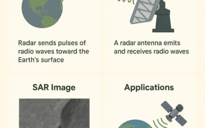
SYNTHETIC APERTURE RADAR (SAR)
1.1 Introduction Synthetic Aperture Radar (SAR) is a type of c by simulating a large antenna...
AutoCAD for Surveyors: Essential Tools for Precision Mapping
Introduction If you’ve ever worked with survey data, you know how important precision is. Every...
Applications of Photogrammetry
Photogrammetry is changing the way we collect, analyze, and visualize spatial data. The...

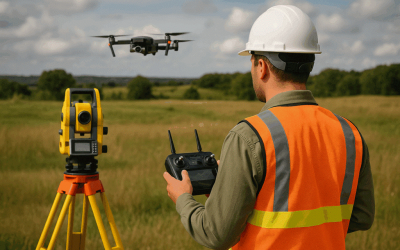
Mastering the Skies: Why Every Modern Surveyor Should Learn Drone Pilot Skills.
In today’s fast-changing geospatial world, drones have become essential tools for professionals...

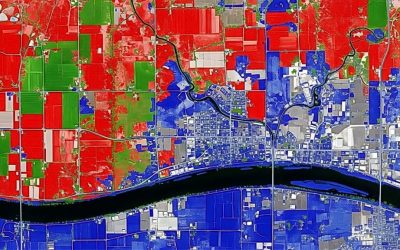
Satellite Image Processing for Long-Term Planning in Nigeria: A Key to Past and Present Information for Transformation
Satellite image processing plays a crucial role in supporting sustainable development and...

DISASTER MANAGEMENT; MAPPING BEFORE AND AFTER: HOW DATA SPEEDS RECOVERY
Disaster management is a multidisciplinary process aimed at reducing the impact of natural and...
SERVICE LIST
We take your industry to the next level. Support Service Geoinfotech

Drone (Survey, Inspection, Surveillance, and Mapping)

Geographic Information System

Land Surveying

Remote Sensing and Satellite Mapping

Hydrographic Survey (Bathymetry)

Geophysical Survey

Training (Beginners to Advance / Professional)

GeoStore (Buy Products) Hardware / Software