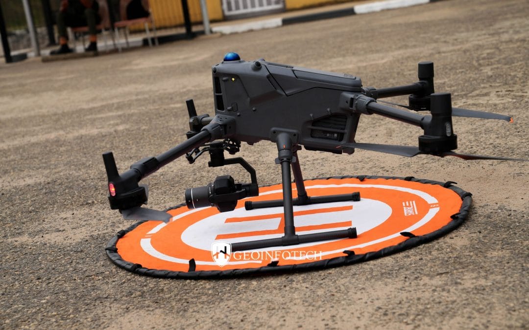
Drone Survey Services in Osun State
Drone Survey Services in Osun State At Geoinfotech, we provide professional drone survey services across Osun State. By combining advanced drone technology with geospatial expertise, we deliver accurate, fast, and cost-effective survey solutions. Unlike many...
REMOTE SENSING TECHNOLOGY – An Overview
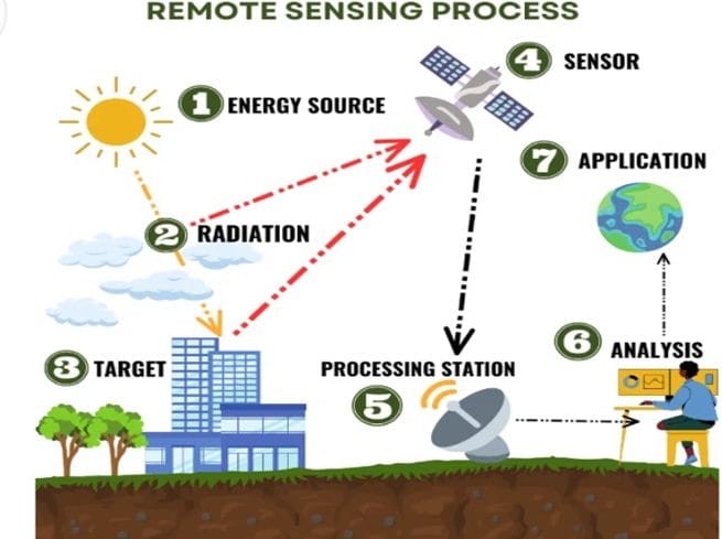
Introduction To Remote Sensing Remote Sensing is the art and science of obtaining information about an object or feature without physically coming into contact. The data collected can be of many forms such as variations in acoustic wave distributions (sonar), force...
REMOTE SENSING TECHNOLOGY – An Overview
Introduction To Remote Sensing Remote Sensing is the art and science of obtaining information about an object or feature without physically coming into contact. The data collected can be of many forms such as variations in acoustic wave distributions (sonar), force...
Where to Buy ArcGIS Desktop Basic (Perpetual License) in Lagos, Nigeria.
Quick Summary Looking for where to buy ArcGIS Desktop Basic (Perpetual License) in Lagos, Nigeria, Abuja, Port Harcourt, Kano, or Kaduna? This guide explains what ArcGIS Desktop Basic is, its key features, benefits, applications, and how to purchase genuine licensed...
[siteorigin_widget class=”wpt_widget”][/siteorigin_widget]
Trending Reviews

How Satellite Imagery is Collected and Processed
How Satellite Imagery is Collected and Processed: Step-by-Step Satellite imagery has transformed the way we understand and monitor the Earth. From tracking climate change and urban expansion to supporting agriculture, disaster management, security, and mapping,...

REMOTE SENSING TECHNOLOGY – An Overview
Introduction To Remote Sensing Remote Sensing is the art and science of obtaining information about an object or feature without physically coming into contact. The data collected can be of many forms such as variations in acoustic wave distributions (sonar), force...

Where to Buy ArcGIS Desktop Basic (Perpetual License) in Lagos, Nigeria.
Quick Summary Looking for where to buy ArcGIS Desktop Basic (Perpetual License) in Lagos, Nigeria, Abuja, Port Harcourt, Kano, or Kaduna? This guide explains what ArcGIS Desktop Basic is, its key features, benefits, applications, and how to purchase genuine licensed...

Where to Buy ArcGIS Bathymetry in Lagos, Nigeria
Quick Summary Looking for where to buy ArcGIS Bathymetry in Lagos, Nigeria, Abuja, Port Harcourt, Kano, or anywhere across the country? This guide explains what bathymetric data is, its applications in marine and coastal projects, and how to access accurate ArcGIS...

All Categories
GIS and Remote Sensing
News
Drone Mapping
Field Work
Stay Up to Date With The Latest News & Updates
New Discount Training Offer!!
The new advance practical and Field Training starts with lots of software’s and professional Staffs
Join Our Newsletter
Be the first to know whats happening, get free updates on our latest post and amazing offers