Introduction Thermal imaging and inspection is a powerful non-contact and non-destructive...


YOU MAY ALSO LIKE...
Introduction Thermal imaging and inspection is a powerful non-contact and non-destructive...

The geospatial industry is growing rapidly, and professionals with strong spatial skills are now...

The rapid evolution of geospatial technology over the last decade has made one thing clear: the...
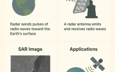
1.1 Introduction Synthetic Aperture Radar (SAR) is a type of c by simulating a large antenna...
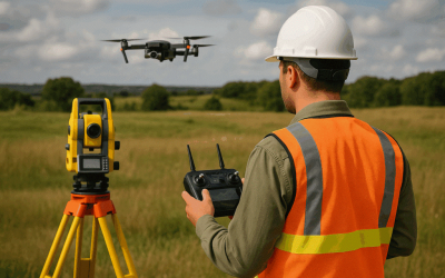
Introduction If you’ve ever worked with survey data, you know how important precision is. Every...
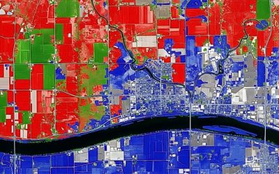
Photogrammetry is changing the way we collect, analyze, and visualize spatial data. The...