A topographic survey is a detailed mapping process that captures the natural and artificial...


YOU MAY ALSO LIKE...
A topographic survey is a detailed mapping process that captures the natural and artificial...

1. Introduction Drone-based quarry mapping refers to the use of Unmanned Aerial Vehicles (UAVs),...

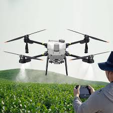
Introduction Drone-powered agriculture refers to the application of Unmanned Aerial Vehicles...

Starting a construction project without a comprehensive spatial data checklist is like...

Project risks can quietly derail timelines, inflate costs, and compromise safety if they are not...
Have you ever wondered how farmers manage to monitor hundreds of hectares of crops without...