Introduction
Drone surveying and mapping have revolutionized various industries by offering efficient, cost-effective, and high-resolution data collection from aerial perspectives. With advanced sensors like high-resolution cameras, LiDAR, and thermal imaging devices, drones provide precise mapping and analysis essential for diverse applications.
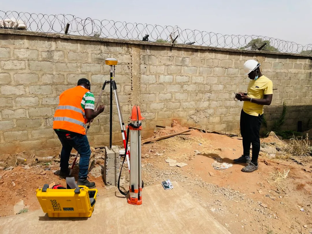
Drones with live-streaming capabilities enable real-time monitoring of construction, environmental changes, and emergencies, enhancing decision-making and on-site efficiency. The Kiara Rice Mill land survey, conducted by Geoinfotech Resources Limited, exemplifies the use of drone technology for detailed topographic analysis.
Drones gather extensive data quickly, reducing the time needed compared to traditional methods. This data can be rapidly processed with photogrammetry, GIS, and 3D modeling software, providing fast survey results and insights. Additionally, drones are environmentally friendly, emitting minimal greenhouse gases and causing less disturbance to wildlife.
The drone survey and mapping of Kiara Rice Mill land, awarded to Geoinfotech Resources Limited in 2024, aimed to assess the topographic features to support the company’s mission and vision, marking the first such survey by Geoinfotech with positive outcomes.
Methodology
Fieldwork for this project was conducted, prior to commencing fieldwork and drone flights, a reconnaissance survey was carried out by the Geoinfotech team. Following the fieldwork, the drone images were analyzed by Geoinfotech’s registered land surveyors, GIS experts, and remote sensing specialists using geospatial software. The resulting maps included:
- Digital Terrain Models (DTMs)
- Contours
- Elevation profiles
- Slope analysis
- River flow
- Drainage basin
Conclusion and Recommendations
The drone survey and mapping of Kiara Rice Mill land by Geoinfotech Resources Limited successfully revealed essential environmental characteristics. The detailed maps of elevation, slope, contour, river flow, DTM, drainage basin, flow accumulation, and orthophotos provide valuable insights for the implementation of Kiara Rice Mill’s mission and vision. These findings support informed decision-making and effective water resource management for the project.