404
Oops!, that page can’t be found.
There are other options that might interest you below
Oops!, that page can’t be found.
There are other options that might interest you below
Search Results

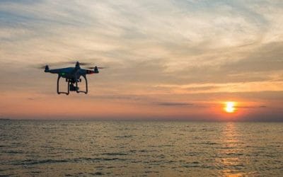
Different Terminologies – Drone, UAV, UAS, RPA or RPAS
Drone UAV UAS RPA or RPAS UAV - UAV is the acronym of Unmanned Aerial Vehicle is the most frequent term. It is used to define the flying object employed for recreational and professional civilian applications. DRONE is mostly the French way by being the world pioneer...
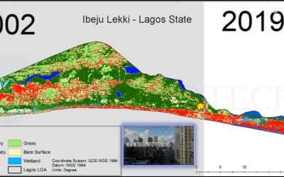
Ibeju Lekki, Lagos State Landuse / Landcover Dynamics
Ibeju Lekki Lagos State IBEJU LEKKI Local Government Area is situated between longitudes 3o44'0" and 4o10'0"N and latitudes 6o25'0" and 6o38'0"E in Tropical Southwestern Nigeria. The area covers approximately 646 Km2 about 25% of the total landmass of Lagos State with...

GIS and Drone Companies in Nigeria
GIS and Drone Companies Leading provider of GIS and (UAV) Drone services in Nigeria. Geographical data collection, aerial photography, Mapping, Data Processing, GIS. Experts in GIS Drone UAV Services, Pipeline Inspections, Gas Leak Detection, Automated Tank...
African Drone Forum-Business Challenge.
“The World Bank is proud to support these promising startups as they gain momentum and continue to push their business ideas forward. By participating in the African Drone Forum, entrepreneurs will get exposure to both local and global players within the drone...
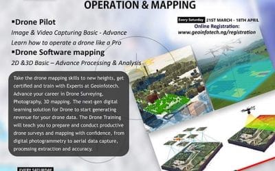
Training on Drone Operation and Mapping
Training on Drone Operation Take the drone mapping skills to new heights and train with Experts at Geoinfotech. Advance your career in Drone Surveying, Photography, 3D Mapping. The next-gen digital learning solution for drone to start generating revenue from your...

NIGERIA EMPOWER TAX SYSTEM WITH GIS
Nigeria’s Federal Inland Revenue Service (FIRS) collaborated with the Abuja Geographic Information System (AGIS) to track properties which should be properly taxed, according to Alhaji Attah Abdullahi, Director of FIRS. In conversation with media during a...
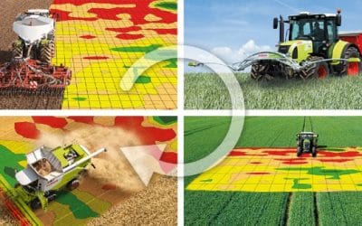
GIS Applications in Agriculture
GIS drone Agriculture mapping Precision Farming –producing more bushels per acre, while using precision farming and software investing less on fertilizers. (Winning the Farm using GIS) Control of diseases–Combating the spread of pests through the detection of critical...
Lagos state uses drone to mointor waterways.
Lagos drones waterways Lagos State the centre for excellence has recently revealed that it has reportedly obtained over 5,000 drones to monitor the waterways as well as search and rescue operations in a bid to protect the lives and property of its passengers. At the...

Drone Service provider and Training in Nigeria
Drone Training in Nigeria At Geoinfotech, we offer drone services and drone training in Nigeria basic to advance, for individuals, government or private companies in Geographic Mapping, Aerial Photography, Disaster Management, Precision Agriculture, Entertainment,...
CONTACT US