404
Oops!, that page can’t be found.
There are other options that might interest you below
Oops!, that page can’t be found.
There are other options that might interest you below
Search Results

Different Job specifications under GIS
Careers GIS industries Careers in GIS are in demand more than ever. Many different industries use geographic information systems (GIS), which makes it available in numerous fields. GIS professionals qualify for occupations in countless fields are: CAD Drafter...

Building a career in GIS world
geospatial GIS Career world Building a career GIS is a technological field that incorporates geographical features with tabular data in order to map, analyze, and assess real-world problems. The keyword of this technology is Geography – this means that some...

Nigeria signs MoU with India Over space cooperation.
Nigeria and the Indian Government have signed a Memorandum of Understanding (MoU) on the usage and exploration of the outer space. The signing of the MoU took place on Thursday 14th of August 2020 during a virtual meeting at the headquarters of the Federal Ministry of...
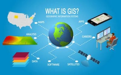
What is Geographic Information System?
GIS data Geography GIS data Geography The geographic information system is a conceptualized framework that provides the ability to capture, store, manipulate, analyze and present all types of geographical data. It is the scientific study of geographic concepts,...

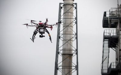
What is a Drone?
Drone robot DRONES Drone in a technological term is used to describe a flying robot that can be remotely controlled or flown autonomously through software-controlled flight plans in their embedded systems, working in conjunction with onboard sensors and GPS. It serve...
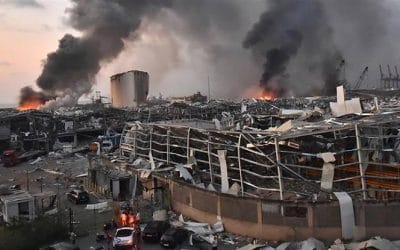
Bomblast tragedy in Lebanese
Bomblast tragedy in Lebanese Disaster Disaster is one of the greatest enemies and havoc to human and its environment.Since 2004, a series of bombing and assassination has struck the land Lebanon mostly around the capital Beruit, but the most recent one shook the...
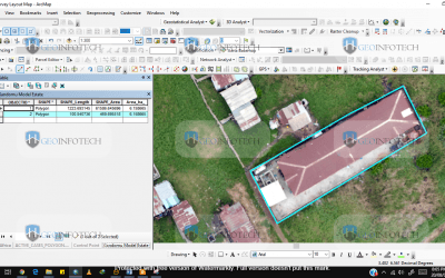
How accurate can your land survey be?
At Geoinfotech we generate precise drone data for your land High resolution scaled orthophotos which will allow you to perform very accurate measurements of distance and surface on what is on the ground. Area measurement can be in a different format (Km2 m2, Hectare,...

Top best cheap drones for photography
Drone photography UAV's The best drone for photography A drone is also known as unmanned aerial vehicles (UAVs) or unmanned aircraft systems (UASes). It is a flying machine that can be remotely controlled through software-controlled flight plans in their embedded...
Drone Laws in Nigeria | Flying Permit
Drone regulations Laws in Nigeria The content on these page is offered based on geoinfotech observation, only as public general information. We do not assure that the information will change or not in due time or accurate, complete or up-to-date. You should always...
CONTACT US