404
Oops!, that page can’t be found.
There are other options that might interest you below
Oops!, that page can’t be found.
There are other options that might interest you below
Search Results
Introduction to Cadastral Management and GIS
Cadastral is the method of registering land, designed to ensure the rights of individuals and the state of their property. GIS as a subset of information systems enables capturing, storing, checking, integrating, analysing and displaying data about the earth that is...

Introduction to WEBGIS
WebGIS has revolutionized every aspect of information distribution, be it news, video, the encyclopedia or how we communicate. WebGIS is an advanced form of geospatial Information System A web GIS is computer software and hardware configuration that allows the...

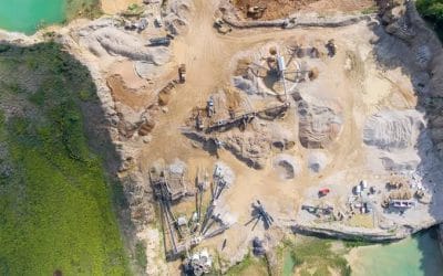
Uses of Drones in GIS
Geospatial Information Systems (GIS) are an indispensable tool for many modern industries with drones (unmanned aerial vehicles (UAVs) which are flexible tools able to satisfy a wide range of professional needs. With applications in construction, real estate,...
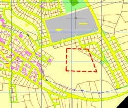
Land Management-Cadastral Land Information System
Land administration is the process whereby land and information about its ownership is effectively in the control of a central authority that regulates the structure and patterns of land ownerships, land use, Land management also give access of the public to land...
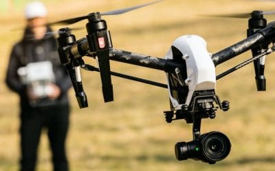
Required Skills and certification to be a Drone Pilot
Skills to Be a Drone Pilot In the world of technology, daily advancement and technical know_how, Drone skills have become a great tool in various industries and being an operator means big profit. There are different job specifications in the world of 'Drones', these...

Fast Growing Industries for Drone Operations.
Drone industries pilot As industries mature, more jobs offers cut across a wide variety of sectors. Drones in Real Estate Drones in Construction / Mining Drones in Filmmaking Drones in Public Safety Drones in Insurance Drones in Journalism Drones in Agriculture Drones...

Fields available in the Drone industry
Many different industries use drones which makes it available in few fields, but drone profession qualifies for occupation in countless industries which are: Drone Engineers: Drone engineers develop drones based on their knowledge of different branches of...

Makoko-Transit from a slum with a new mapping project.
Makoko waterfront slum In recent years, concerned authorities responsible for safety and security in Lagos, Nigeria has been in the business of the eviction and demolition of prime waterfront slum/ communities in the state due to reasons that are subjected to the...

Helicopter crashed into a residential building
A helicopter said to operated by Quorom avaition coming from PortHarcout crashed into a residential building at Salvation Opebi road, Ikeja area of Lagos. It was reported to have carried 3 passengers, 2 crew members and a passenger. [video...
CONTACT US