404
Oops!, that page can’t be found.
There are other options that might interest you below
Oops!, that page can’t be found.
There are other options that might interest you below
Search Results

Benefits of GIS in Urban Planning and Development
Urban planning is the process of both developing and designing open land, urban areas, and the built environment. Urban planners, sometimes known as city planners, design cities and create plans for future improvements and growth, which includes much of what you see...
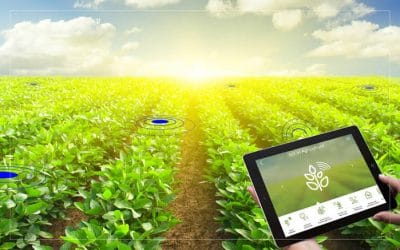
How GIS can be used to Develop Agriculture Sector.
GIS in agriculture is not a new phenomenon anymore. The agricultural sector is the mainstay of the rural part of most economies around which socio-economic privileges and deprivations revolve, and any change in its structure is likely to have a corresponding impact on...
ArcGIS Pro Latest Version.
As the GIS industry continues to evolve and advance, Esri has maintained its commitment to bringing diverse, smooth-running software, apps, and services to its users. ArcGIS Pro is the latest professional desktop GIS application from Esri. With ArcGIS Pro, you can...

Spatial Receives Esri’s Utility Network Management Specialty.
Spatial, an Esri business partner and global geospatial software and solutions company, is pleased to earn the Utility Network Management Specialty designation. Spatial has been recognized by Esri for knowledge and expertise with utilities and the implementation of...

Bluesky 3D building Models Drive Efficiency and Collaboration in Water Construction
The Bluesky 3D models provide us with a crucial understanding of locations we are working in,” commented Stephen Kennedy, Head of Digital & Innovation at MWH Treatment. “They provide initial site intelligence and inform true visualizations for our Visual Project...
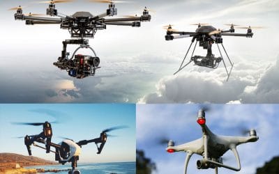
HOW WILL DRONE AFFECT THE FUTURE?
Introduction. Drone was first used by Militaries as a weapon of warfare, initial use of the technology in reconnaissance and ground attack roles. But over time, drones or UAV’s has been and is currently in use in various sectors of the economy, the most apparent...

Difference Between Aerial Mapping and Photograph
Introduction An aerial photograph in broad terms is any photograph taken from the air, Aerial photography is the production of photographic images from balloons, helicopters or aeroplanes; it's used primarily for mapping. Maps are graphic representations of selected...

Council uses drones to warn public to follow the coronavirus advice.
Staying aware of the most recent news on Coronavirus information by keeping to date from WHO and also through the information gathered from local public health personnel’s. In recent news, drone speakers were been used by the council to tell people to stay indoors...

Robotic drone inspired by world’s fastest bird can replicate movements
Research shows that nature has been a source of inspiration over time, especially for the field of robotics. This has led to imitations that have improved the number of biologically inspired robots that could use everything from surveillance operations to flower...
CONTACT US