404
Oops!, that page can’t be found.
There are other options that might interest you below
Oops!, that page can’t be found.
There are other options that might interest you below
Search Results
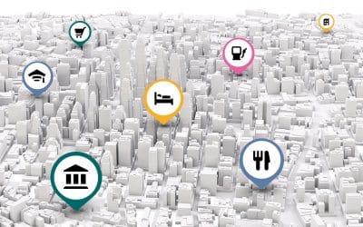
GIS Benefit to Logistics
GIS benefit to Logistics involves the process of planning and executing the efficient transportation and storage of goods from the point of origin to the point of consumption. Pre-planning: At Geoinfotech developing system design based on GIS, is what we encourage,...

GIS in Business
The application of GIS in business cannot be overemphasized as this enables the proper management and functionality of the business. The GIS services rendered at Geoinfotech can be applied in the following business and many more Dairy Industry; Did I hear to say...

Land Surveying Cost in Nigeria
LAND SURVEY COST IN NIGERIA “We do not intend to provide a survey for just today, but for years to come”. “Better yet, what if I showed you how to leverage cost for surveying your land in Nigeria”. There are great professionals to have on your speed dial, but you...
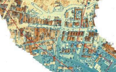
A geographic Database
A geographic database is a database that is associated with a location on the earth in some way. In addition to this data, there is usually data called attribute data. Generally, attribute data is defined as other information that can be associated with spatial data....
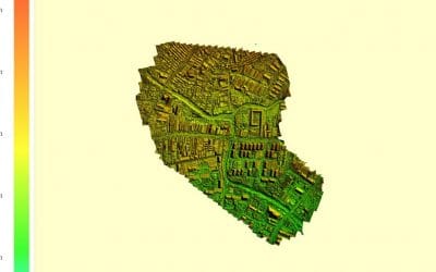
GIS Mapping
GIS map is an indispensable tool for displaying geophysical data about the world on the screen in a dynamic and interactive way. According to the problem to be solved, there are many types of map mapping in GIS, from category maps to bubble maps to heat maps. GIS maps...
Top 7 Drone Manufacturing Companies
There are some fantastic drone producers, companies from across the globe, those drone agencies produce quadcopters, hexacopters and extra out of the whole lot from foam to high-grade substances like carbon fibre in expert gear. There are many drones to pick out...

Geographic coordinate system(GCS) and Projected coordinate system (PCS)
The geographic coordinate system (GCS) is a coordinate system that defines the location of objects in the earth model. It has a spherical shape: a spherical shape. Its unit is a square, usually degrees. The projected coordinate system (PCS) is flat. It contains a GCS...

Development of Drones in the Agricultural Sector
This strong demand forces of the Agriculture sector to innovate and find new ways to overcome obstacles to increasing productivity. Drones are one of the solutions that are already available, which can increase the productivity of farmers. By the end of 2050, the...
Effect of GIS Application to Bank Industry
Evaluating the attractiveness of the market in which branches operate using GIS can help the bank industry decide whether to reduce their presence in that market and assess the risks involved. Many advantages that other data types cannot achieve. Financial...
CONTACT US