404
Oops!, that page can’t be found.
There are other options that might interest you below
Oops!, that page can’t be found.
There are other options that might interest you below
Search Results
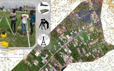
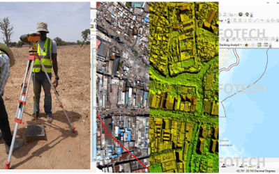
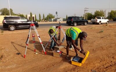
Topographic Surveying and Survey Plan services
Surveying Services in Nigeria Land Surveying is a technique used to make accurate measurements in determining both man-made and natural features, positions of points, the distances and angles between property boundaries accurately. There are various types of land...

Geospatial analytics companies
Geospatial analytical companies; Genesys International; Genesys International Corporation Ltd is a geospatial analytics company established in 1995. We are pioneers in advanced mapping, surveying, and geospatial services. With a team of 2000+ professionals and rich...

Amazon using drones
Amazon has unveiled the latest version of its Prime Air delivery drone, a hybrid aircraft that’s capable of vertical takeoff and landing as well as sustained forward flight. The company says it wants to launch a delivery service of the drone in “the coming months,”...
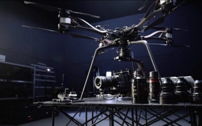
DJi heavy lift drones
DJI is a commercial manufacturer of unmanned aerial vehicles (drones), used to take aerial photography and videography. With their origin in china, DJi heavy lift drones have been said to give seamless amazing shots and videos for remarkable memories, over time. One...
Geo Mapping With Drone
Geo Mapping With Drone What is Geo Mapping; Geo-mapping software enables one to take spreadsheet information (raw materials) and create a visualizing Geo map that’s most suited to analyzing your data. Geo Maps are significantly efficient as it explains data that is...

Drone camera brands
Drone camera brands Sorting for a reliable drone brand doesn’t have to be a chore. When searching for something you can easily carry make mobile, or bring with you on vacation, then a good drone brand could be the solution. Different drones weigh a couple of pounds,...
PROPERTY LINE SURVEY
Property Lines is a term used to define the beginning to which a line originates from to the point where it eventually ends. And in other to be an owner of a property it is advised that you understand the meaning of a property line to avoid any form of dispute that...
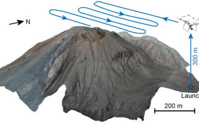
UAS Activity in GIS
Unmanned Aerial Systems (UAS), or “drone technology activity in GIS,” is a trending topic amid several disciplines, most of which are held together with the GIS. Drones are excellent for taking high-quality aerial photographs and video and collecting vast amounts of...

Long range drone will Enhance Security, Boost Economic Growth
Drone technology is commonly deployed in our everyday lives, from taking selfies to the make-believe world where the small airplane-like technology tool helps film directors capture aerial images. However, there are a lot more drones can do and an indigenous Nigerian...
CONTACT US