404
Oops!, that page can’t be found.
There are other options that might interest you below
Oops!, that page can’t be found.
There are other options that might interest you below
Search Results

Hydrography
Hydrography Hydrography is the branch of applied sciences that deals with the measurement and description of the physical features of oceans, seas, coastal areas, lakes, and rivers. It also predicts occurring changes in the water bodies over time, for the...

Importance Of Land Survey
Importance Of Land Survey What is Land Survey Land Survey or simply Survey, is the scientific process of measuring the dimensions of a particular area of the earth's surface, including its horizontal distances, directions, angles, and elevations. Artificial structures...

7 Ways Geospatial Data Helped During The Outbreak Of Covid-19
7 WAYS GEOSPATIAL DATA HELPED DURING THE OUTBREAK OF COVID-19 Geospatial Data Helped During Covid-19 Geographic information science (GIS) has been established as a distinct domain and is incredibly useful whenever the research is related to geography, space, and other...
Gis for Beginners
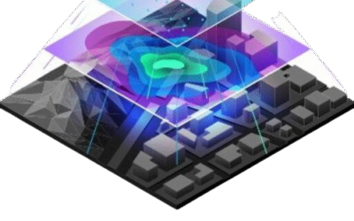
GIS FOR BEGINNERS. A geographic information system (GIS) is a tool for collecting, organizing, managing, manipulating, analyzing, storing, and presenting many types of spatial data. Sounds encompassing, right? How does this tool affect me as an average person? Anyway,...
How Can Gis Be Used To Estimate Flood Damage?
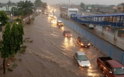
How Can Gis Be Used To Estimate Flood Damage? We are currently in the rainy season here in Nigeria. In many areas, as people are happy to have the rains, including farmers and ranchers, others are unhappy due to the damages the heavy rains could cause to roads and...

GIS and the Environment
GIS and the Environment GIS means Geographic Information Systems. It is a potent tool for environmental data analysis and planning. Through the application of GIS technologies, the environment can be monitored for an effective and improved understanding of its...

GIS VS GPS: What’s The Difference?
GIS VS GPS: What’s The Difference? One might wonder what the difference is between GIS and GPS. At a glance, one might wonder what the difference is between both terms. It is important to highlight the variance between both abbreviations as many take them to be...

Bathymetry from Space
BATHYMETRY FROM SPACE According to Wikipedia definition, Bathymetry is the study of the underwater depth of ocean floors, lake floors, or river floors. It is the underwater equivalent of topography. The first recorded evidence of water depth measurements is from...

What Is The Difference Between Geospatial And GIS?
What Is The Difference Between Geospatial And GIS? WHAT IS GEOSPATIAL? All forms of GIS are a type of geospatial technology, but not all geospatial technology is a form of GIS. More specifically, Geospatial is a broad term that defines the collective...
CONTACT US