404
Oops!, that page can’t be found.
There are other options that might interest you below
Oops!, that page can’t be found.
There are other options that might interest you below
Search Results

How GIS Can Be Used to Enhance Transparency and Accountability in Public Policy and Decision-making
How GIS Can Be Used to Enhance Transparency and Accountability in Public Policy and Decision-making How GIS Can Be Used to Enhance Transparency and Accountability In today's digital age, Geographic Information Systems (GIS) have revolutionized the way public policy...

The Role of Gis in the Internet of Things (Iot) Opportunities and Challenges for Spatial Data Analytics
The Role of Gis in the Internet of Things (IoT) Opportunities and Challenges for Spatial Data Analytics The Role of Gis in the Internet of Things The internet of things, or IoT, is a networked system of interconnected computing devices, mechanical and digital...

Mapping the Nigerian Future – How GIS Impacts Elections
Mapping the Nigerian Future - How GIS Impacts Elections How GIS Impacts Elections Geographic Information Systems is a fast-growing field in data management and problem-solving in society. The Geographic Information System no doubt helps us to understand spatial...
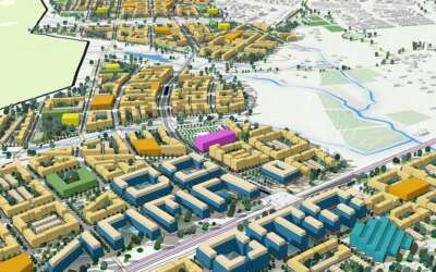
How GIS Can Be Used to Support Smart City Planning
How GIS Can Be Used to Support Smart City Planning How GIS Can Be Used to Support Smart City Planning GIS (Geographic Information System) is a powerful tool that can be used to support smart city planning. A smart city is one that uses technology and data to...
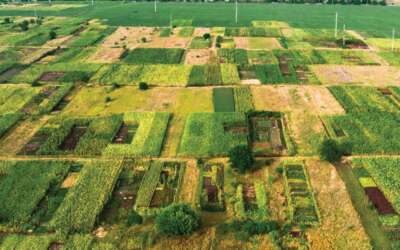
Zoning and Land Use Regulation Using GIS
Zoning and Land Use Regulation Using GIS Zoning and Land Use Regulation Using GIS Land use Regulations and Zoning are methods/tools used by the government to restrict how the land can be used. Zoning is essential for regulating the spatial layout and the development...
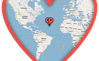
Mapping the Most Romantic Places Using GIS Technology
Mapping the Most Romantic Places Using GIS Technology Valentine's Day is just around the corner and love is in the air. Whether you're in a relationship or not, it's a great time to celebrate the power of love and all the amazing things it can bring into our lives. If...
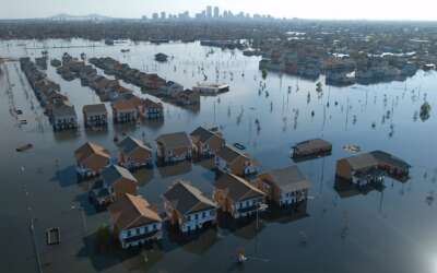
How GIS is Used to Solve Disaster Response and Recovery Efforts
How Gis is Used to Solve Disaster Response and Recovery Efforts GIS in Disaster Response and Recovery Efforts GIS can be used to solve disaster before it happens or make the impact of such disaster minimal. A few analysis needs to be carried out on whatever disaster...

Exploring Emerging Trends and Technologies in GIS and Disaster Management Including the Use of Artificial Intelligence Machine Learning and Big Data Analytics
Exploring Emerging Trends and Technologies in GIS and Disaster Management Including the Use of Artificial Intelligence Machine Learning and Big Data Analytics Exploring Emerging Trends and Technologies in GIS and Disaster Management Disasters can strike...

Introduction to Drone Surveying Training
Introduction to Drone Surveying Training Greetings Professional Colleagues It is said that... “ Great situation calls for Greater measures ” As we all know Surveying has evolved from the times of Gunter’s chain and the use of theodolites. With the advancement...
CONTACT US