404
Oops!, that page can’t be found.
There are other options that might interest you below
Oops!, that page can’t be found.
There are other options that might interest you below
Search Results
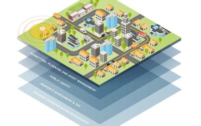
GIS Applications in Supporting SDG Goals
Geographic Information Systems (GIS) are powerful tools that can be used to visualize, analyze, and understand spatial data. This makes them invaluable in supporting the United Nations Sustainable Development Goals (SDGs), which aim to address global challenges like...
Beyond Maps: Surprising ways GIS impact our world
Geographical Information Systems (GIS) have evolved from simple mapping tools to increasingly being vital in various sectors globally, and Nigeria is no exception. The country has started leveraging GIS to tackle complex challenges in public health, logistics, and...
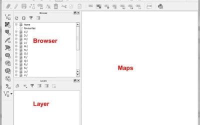
Getting Started with ArcGIS: A Beginner’s Guide
ArcGIS is a powerful Geographic Information System (GIS) software suite used for creating, analyzing, and managing spatial data. Whether you're a student, a professional, or simply an enthusiast eager to explore the world of GIS, this beginner’s guide will help you...
GETTING STARTED WITH QGIS: A Beginner’s Guide
Geographic Information System (GIS) software has revolutionized the way we work with spatial data. Among the most popular tools in this field is QGIS, an open-source platform that offers powerful GIS tools for beginners and experts alike. In this guide, we’ll walk you...

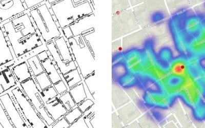
The Magic Behind the Maps: How GIS Combines Data and Geography
Imagine holding a key that unlocks the hidden patterns of our world—the spread of cities, the retreat of forests, or the flow of traffic through a bustling metropolis. That key is Geographic Information Systems (GIS), quietly shaping the way we understand and interact...
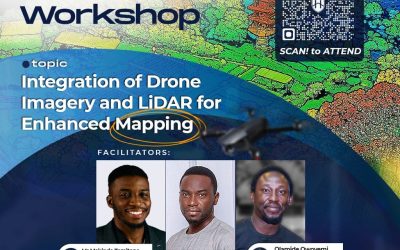
Unlock the Future of Surveying: Free Drone Imagery and LiDAR for Enhanced Mapping
Are you ready to dive into the future of surveying and geographic information systems (GIS)? Drone mapping with LiDAR technology is revolutionizing how we capture data, build accurate 3D models, and understand landscapes like never before. Whether you’re a...

Where to Get Affordable Cheap Drones in Nigeria?
In today’s fast-paced digital era, businesses must embrace cutting-edge technology to gain a competitive edge. Drone technology is one such breakthrough that has altered a variety of sectors. Drones have become a vital tool for businesses all over the world due to their capacity to shoot aerial imagery,

3D GIS: From Visualization to Analysis
Unlike 2D which provides a 2-Dimensional view (X, Y) indicating positions, 3D GIS shows or tells us more details about the object of interest as a result of the presence of a third variable Z. Z can represent a variety of attributes depending on its application. from...

How GIS Is Revolutionizing Real Estate Development
Geographic Information Systems (GIS) are transforming the real estate development industry by offering new ways to analyze and understand land, property values, and market trends. This technology helps developers, investors, and planners make smarter decisions by...
CONTACT US