404
Oops!, that page can’t be found.
There are other options that might interest you below
Oops!, that page can’t be found.
There are other options that might interest you below
Search Results
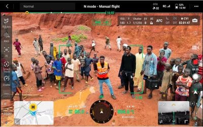
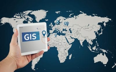
Geoinfotech Uses Drone and GIS Technology to Uncover the Source and Solution to the Devastating Mokwa Flood
In a bid to address the devastating effects of the recent flooding in Mokwa, Niger State, Nigerian geospatial firm Geoinfotech Resources Ltd deployed cutting-edge drone and GIS technology to trace the root cause, assess the damage, and propose lasting solutions. The...
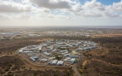
How Geospatial Technology is Powering Africa’s Smart City Revolution
Smart cities are rapidly emerging as a transformative model for urban development, particularly across Africa where urbanization is accelerating. As governments and city planners grapple with challenges like overcrowding, waste management, traffic congestion, and...
How Drone Mapping Is Revolutionizing Land Surveying in Nigeria
Land surveying has always been a critical part of development in Nigeria. Whether it’s for real estate, road construction, mining, agriculture, or urban planning, understanding the land is always the first step. For years, surveyors have depended on manual tools and...

GIS for Transportation: Optimizing Routes, Reducing Traffic, and Saving Fuel.
Transportation is the lifeblood of any economy — from the movement of goods across supply chains to the daily commute of urban populations. But as traffic congestion, fuel costs, and environmental concerns grow, the demand for intelligent, data-driven transportation...

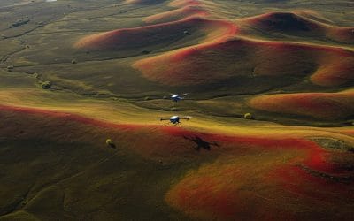
OPTIMIZING AGRICULTURAL PRODUCTIVITY; LAND USE MAPPING FOR MODERN FARMS
In the evolving landscape of global agriculture, optimizing productivity is a continuous pursuit, crucial for ensuring food security and economic resilience. A pivotal innovation in achieving this goal is Land Use Mapping, a powerful application leveraging the...

HOW GEOSPATIAL TECHNOLOGY SUPPORTS DISASTER RESPONSE DURING THE 2025 MOKWA FLOODS
In May 2025, the town of Mokwa in Niger State, Nigeria, experienced one of the most catastrophic floods in the country's recent history. Heavy rains, the collapse of a local dam, and rising river levels combined to devastate the region. Over 200 lives were lost, more...
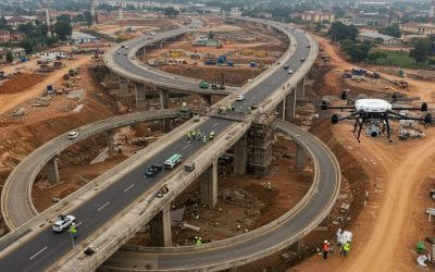
How Drone Technology is Revolutionizing Construction and Infrastructure in Nigeria
The construction and infrastructure sectors in Nigeria are booming—but so are the challenges: outdated site data, delayed surveys, inaccurate measurements, and costly rework. That’s where Geoinfotech’s drone solutions are stepping in to make a game-changing...
GIS: A DRIVER FOR SMARTER BUSINESS STRATEGIES
What if the secret to your business's next big win was hidden in plain sight, just waiting to be understood from a new perspective? It's not magic, it's Geographic Information Systems (GIS). Think of it as far more than just maps; it's the ultimate tool for figuring...
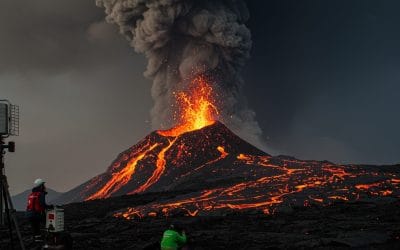
Harnessing GIS and Remote Sensing for Volcanic Eruption Monitoring and Disaster Management.
Volcanoes, while spectacular, represent a serious geohazard capable of reshaping landscapes and disrupting societies in moments. Understanding, predicting, and mitigating volcanic eruptions require not only geological insight but also the integration of powerful...
CONTACT US