404
Oops!, that page can’t be found.
There are other options that might interest you below
Oops!, that page can’t be found.
There are other options that might interest you below
Search Results
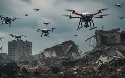
Drones in Disaster Response and Recovery: Revolutionizing Crisis Management
When disaster strikes—whether it’s a hurricane, earthquake, or wildfire—every second counts. Emergency responders need accurate, real-time data to save lives, assess damage, and coordinate recovery efforts. Enter drones: small, agile, and equipped with cutting-edge...
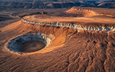
Remote Sensing and Gis for Mineral Exploration
Discovering Hidden Treasures Beneath the Surface with Spatial Intelligence The quest for mineral resources is no longer left to chance or guesswork. The fusion of Remote Sensing and Geographic Information Systems (GIS) has revolutionized mineral exploration—bringing...
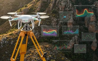
The Interrelationship of Surveying, Geospatial Analysis, and Drone Technology.
In an era where location data has become central to decision-making, infrastructure planning, and environmental management, the roles of surveyors, geospatial analysts, and drone pilots have grown not only in relevance but also in connectivity. These three...
Topology in GIS: Beyond Geometry — Understanding Spatial Relationships
In the world of Geographic Information Systems (GIS), geometry may be the star of the show—but it’s topology that gives the performance its meaning. While geometry tells us where things are, topology tells us how those things are related. And in spatial analysis,...
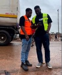
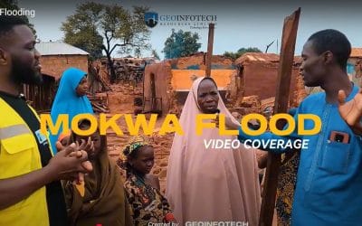
What Happened in Mokwa: How Drone and GIS Technology were used to uncover the source, extent and solution to the devastating Mokwa Flood
A Summary of the Flooding Incident at Mokwa On May 29, 2024, a devastating flash flood struck Mokwa town in Niger State, destroying 381 buildings and displacing many residents. The flood began around 6:00 AM, sending water as high as 4 meters rushing through...
What Happened in Mokwa: A Simple Explanation
A Summary of the Flooding Incident at Mokwa On May 29, 2024, a devastating flash flood struck Mokwa town in Niger State, destroying 381 buildings and displacing many residents. The flood began around 6:00 AM and sent water as high as 4 meters rushing through the...
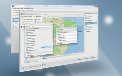
INSTALLING AND VISUALIZING DATA IN QGIS – Series 2
In our first post, we explored what QGIS is, why it matters, and how organizations use it for spatial analysis and decision-making. Now that you understand the “what” and “why,” this post moves us into the “how.” Here, you’ll learn how to install QGIS and load your...

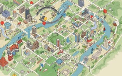
MAPPING THE FUTURE: HOW GIS POWERS SMART CITIES
When we talk about “smart cities,” we often imagine self-driving cars, intelligent traffic lights, and waste bins that alert sanitation teams when they’re full. But behind this futuristic vision is a powerful, less visible technology: Geographic Information Systems...
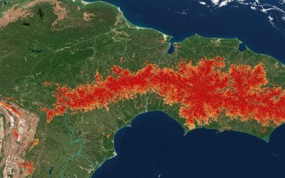
TRACKING DEFORESTATION OVER TIME USING LANDSAT DATA IN GOOGLE EARTH ENGINE
Forests are among Earth’s most vital ecosystems, but they’re vanishing at an alarming rate. From illegal logging to agricultural expansion, deforestation is a global challenge with serious ecological, social, and climatic impacts. Thankfully, geospatial tools like...
CONTACT US