404
Oops!, that page can’t be found.
There are other options that might interest you below
Oops!, that page can’t be found.
There are other options that might interest you below
Search Results

Environmental Management: Concepts, Objectives, Principles & Core Components
Concept of Environmental Management Environmental management refers to the scientific and strategic process of regulating, protecting, and sustainably utilizing environmental resources. It helps reduce human impact on natural systems and ensures a balanced...

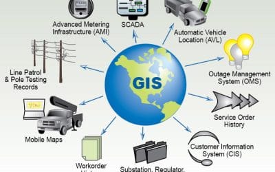
The Power of Spatial Data: How GIS Is Shaping Environmental Management When you think about the environment, you probably imagine forests, rivers, coastlines, cities, farms, and the spaces in between. But behind every one of these landscapes is a quiet layer of...

Top Mapping Techniques Every Surveyor Should Know
In today’s fast-evolving geospatial world, precision, speed, and reliability are non-negotiable. Surveyors are expected to deliver accurate land information for planning, engineering, construction, environmental management, and countless other applications. Modern...

How Geo-Innovation Is Driving Sustainable Development
Sustainable development has become a daily priority rather than a distant aspiration. As environmental pressures intensify and cities grow rapidly, geo-innovation now provides the critical tools needed for smarter, more sustainable decision-making. From climate-risk...

GEOGRAPHIC INFORMATION SYSTEM (GIS) AND GEOSPATIAL TECHNOLOGY IN NIGERIA
Introduction Geographic Information Systems (GIS) and geospatial technology continue to reshape how Nigeria collects, manages, and uses location-based information. These technologies help organizations visualize, analyze, and understand data based on where events and...
UNDERSTANDING GIS AND GEOSPATIAL TECHNOLOGY
Introduction Geographic Information Systems (GIS) and Geospatial Technology are modern technological tools used for capturing, storing, analyzing, managing, and visualizing data that is associated with specific geographic locations. Geographic Information Systems...

HYDROGRAPHIC SURVEYING
Introduction Introduction Hydrographic surveying, also known as bathymetric surveying, involves the precise measurement and mapping of underwater terrain or seabed topography. It provides essential data for navigation safety, marine engineering, dredging, and...

5 Ways GNSS RTK Makes Construction and Farming More Accurate
If you’ve ever used GPS on your phone and ended up a few meters off from your destination, you know how small errors can throw things off. Now imagine that same inaccuracy happening on a construction site or in a large farm field where every centimeter counts. That’s...

SIGNIFICANT INFORMATION ON CROP MONITORING USING REMOTE SENSING
Integrated Workflow Crop monitoring through remote sensing follows a structured workflow that transforms raw imagery into actionable agricultural intelligence. The process are firmly summarised as follows: Data Acquisition: Multispectral, hyperspectral, SAR, or...
CONTACT US