404
Oops!, that page can’t be found.
There are other options that might interest you below
Oops!, that page can’t be found.
There are other options that might interest you below
Search Results

Visualizing Nigeria: A Deep Dive into Land Use and Land Cover (LULC) Dynamics
Understanding our terrain is the first step toward sustainable development. In the realms of geography and environmental science, Land Use and Land Cover (LULC) serve as the foundational blueprints for managing our planet. While often used interchangeably, they...
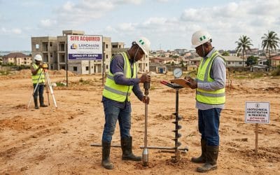
Why Every Real Estate Developer in Nigeria Must Do a Soil Test Before Buying Land
Why Every Real Estate Developer in Nigeria Should Do a Soil Test Before Buying Land Imagine investing hundreds of millions of Naira into a prime piece of real estate in Ibeju Lekki or the heart of Abuja, only to watch your structure develop massive cracks or, worse,...

How to Upgrade Your Surveying Fleet in Lagos, Nigeria (GeoStore Guide 2026)
How to Upgrade Your Surveying Fleet at GeoStore Lagos This March If you’re a surveyor, drone pilot, or geospatial professional in Nigeria, you already know one thing: your equipment determines your accuracy, speed, and overall project success. And with increased...

What Happens When You Skip Engineering Surveying Before Construction in Lagos, Nigeria
What Happens When You Skip Engineering Surveying Before a Construction Project Imagine starting a building project only to discover midway that the land slopes incorrectly, the foundation is misaligned, or parts of the structure fall outside the property boundary....

DJI Dock 3 for Remote Site Monitoring in Lekki Free Trade Zone, Lagos – Is It the Best Solution?
Remote Site Monitoring: Is the DJI Dock 3 the Best Solution for Lekki Free Trade Zone? In a fast-growing industrial hub like the Lekki Free Trade Zone, security, efficiency, and real-time visibility are no longer optional; they are critical. With massive...

5 Ways GIS Helps Real Estate Developers Make Better Land Decisions in Lagos, Nigeria
5 Ways GIS Technologies Help Real Estate Developers Make Better Land Decisions How do real estate developers choose the best land for their projects while avoiding costly mistakes? In Nigeria, where urban growth is rapid and land dynamics are constantly changing,...

How Hydrographic Surveying Works on Nigeria’s Inland Waterways and Coastal Zones?
Have you ever wondered how ships safely navigate rivers, ports, and coastal waters without running aground? Picture a vessel moving through the busy waterways of Lagos or along the Niger River. Without accurate depth information, navigation would be risky and slow....

How to Beat Lagos Traffic: Using DJI FlyCart 100 for Heavy-Lift Delivery
If you live or work in Lagos, you already know one thing, traffic can slow down everything. From Apapa to Victoria Island, Lekki to Ikeja, logistics delays cost businesses time, money, and customer trust. But what if there was a faster, smarter way to move goods...

DO NOT BUY LAND BLINDLY WITHOUT CONSULTING A SURVEYOR AND CONDUCTING A PROPER LAND SURVEY
Introduction Land is one of the most valuable and permanent assets anyone can acquire. Whether it is purchased for residential development, agriculture, investment, or commercial purposes, land ownership requires careful verification and proper documentation. In many...
CONTACT US