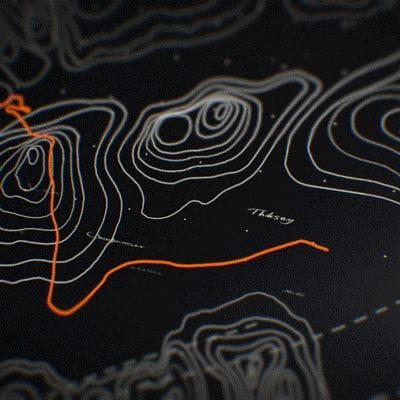
Remote Sensing and Satellite Image Mapping
Committed to on-time product delivery, accurate and precise data.

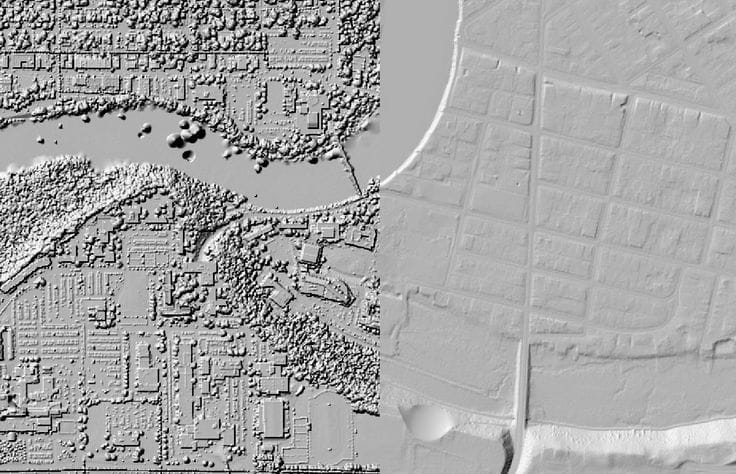
Imagery
Remote Sensing and Satellite Image Mapping Services
We decipher the Earth's secrets from above, harnessing the power of satellite
and drone technology to provide key insights. Our services utilize advanced
remote sensing and satellite image mapping.
Our comprehensive services, which turn complex data into actionable
intelligence, include the following:

Satellite Image Acquisition and Integration


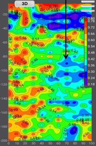
Image Processing and Spatial Data Modeling


LiDAR (Light Detection and Ranging)


Land Use / Cover Image Classification and Change Detection


Radar Imaging


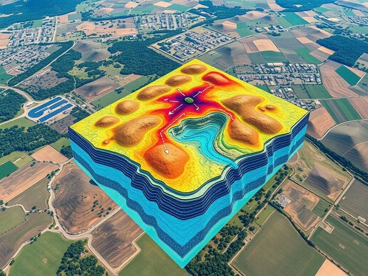
Digital Elevation Model (DEM) Generation


Crop Monitoring and Yield Prediction

Flood Mapping
Environmental Monitoring

Natural Resource Management
Disaster Management
Aerial Photography
Vegetation Index Mapping
Thermal Imaging

Geo Store

GIS Training And Consulting
Project
Featured Remote Sensing Service
Workflow
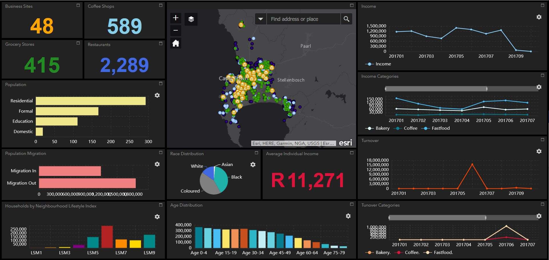
GIS Data Analysis and Mapping
At Geoinfotech we offer a wide range of tasks and applications related to managing, analyzing, and visualizing geospatial data. Geographic Information System Services
Application
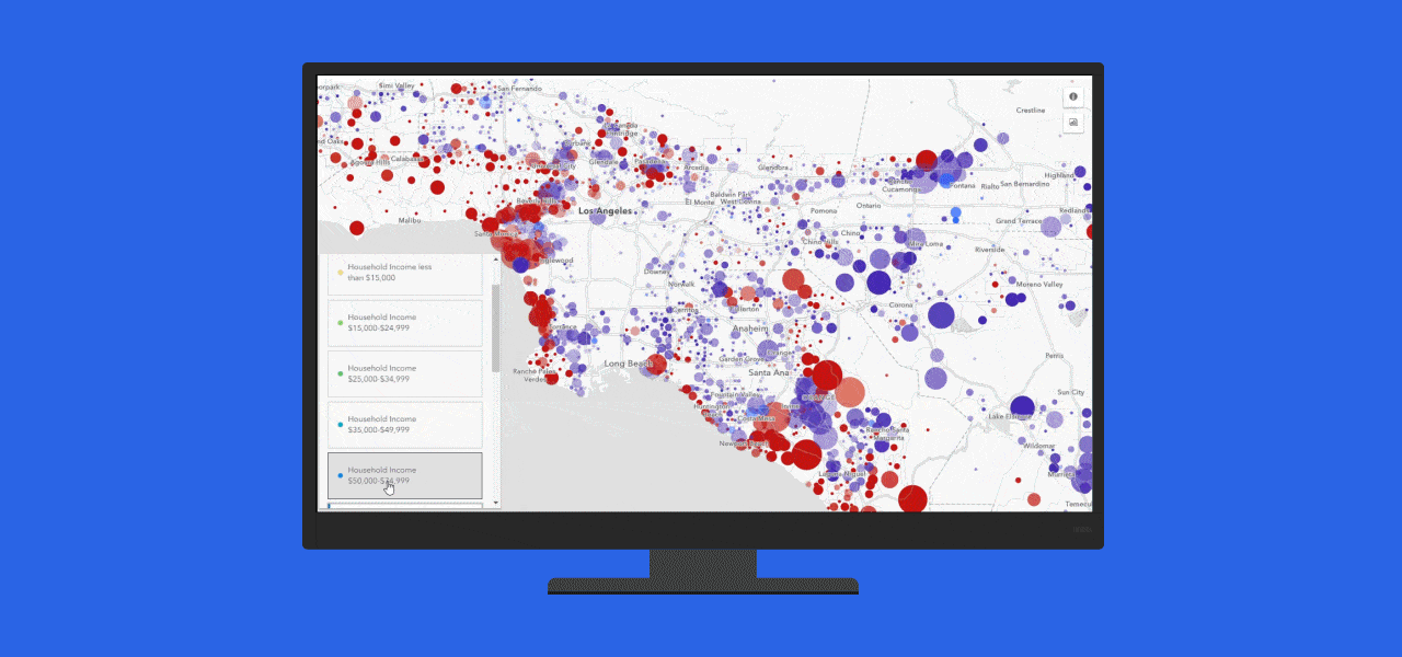
Satellite Mapping
“Our extensive knowledge and expertise in advanced data analysis techniques, and dedication to staying updated with the latest advancements in the field allow us to deliver unparalleled insights and solutions. We make top analysis for our clients seeking the highest level of quality results.”
WHAT WE OFFER
Our Portfolio
Check out our previous projects on GIS, Drone, Land Surveyor and Mapping Services in Nigeria

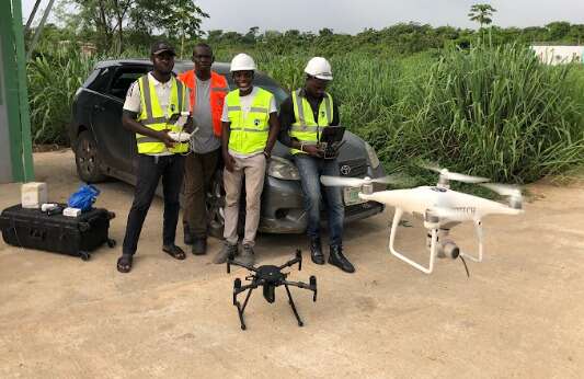
Drone Training for Corporate Security - Sahara Group
Drone category, Drone operation and mapping, Geographic Information System (GIS) category, GIS and Remote sensing, Organisation Training, Training and Workshop
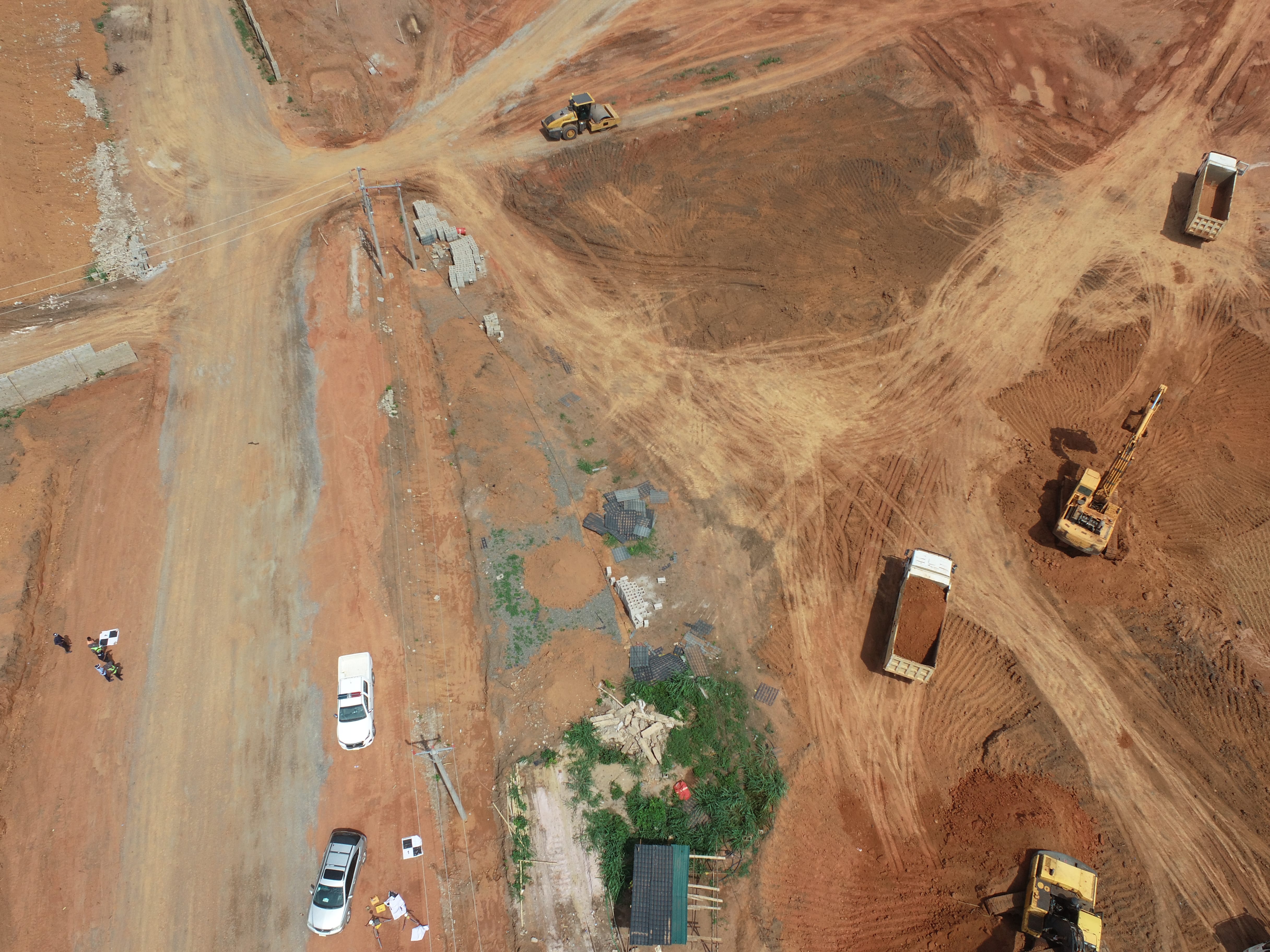
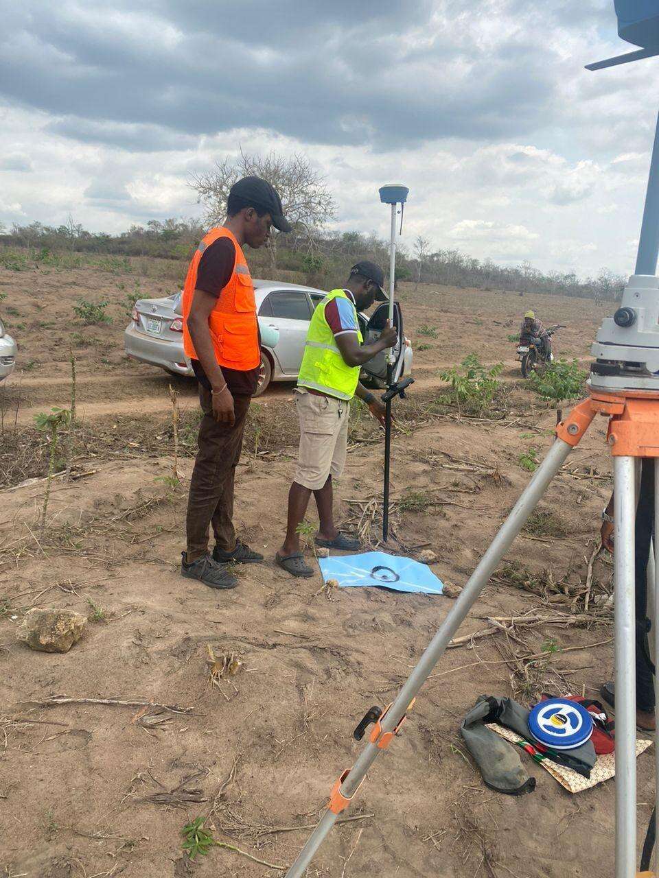
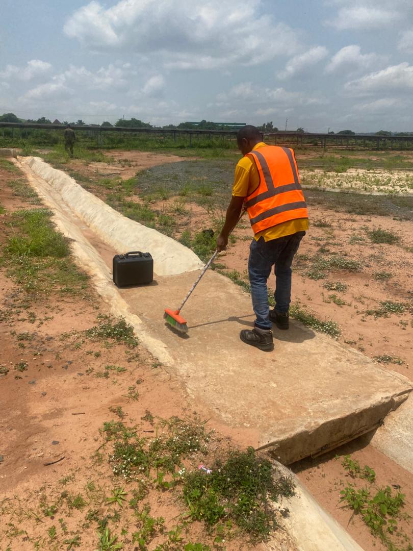
Aerial Survey & Mapping - Ogun State
Drone category, Drone operation and mapping, Geographic Information System (GIS) category, GIS and Remote sensing, Surveying
Thermal Drone Inspection - Enugu Solar Site
Drone category, Drone operation and mapping, GIS and Remote sensing, Surveying