Drones, also known as unmanned aerial vehicles (UAVs), have become a game-changer in the field of remote sensing with the use of specialized sensors like LiDAR (Light Detection and Ranging) and hyperspectral cameras. These advancements are transforming remote sensing into a more precise, efficient, and cost-effective practice, enabling researchers and professionals across various fields to gain deeper understanding of the environment which is why at Geoinfotech, we are the leading users of drone technology for remote sensing applications to produce very accurate and precise models and maps at high resolution. Drone application in remote sensing comes with numerous advantages which includes:
Sensor Sophistication:
- LiDAR allows for highly detailed 3D mapping of terrain and vegetation.
- Hyperspectral cameras capture data across a wider range of the electromagnetic spectrum, enabling analysis of things like plant health, mineral composition, and water quality.

Improved Data Collection:
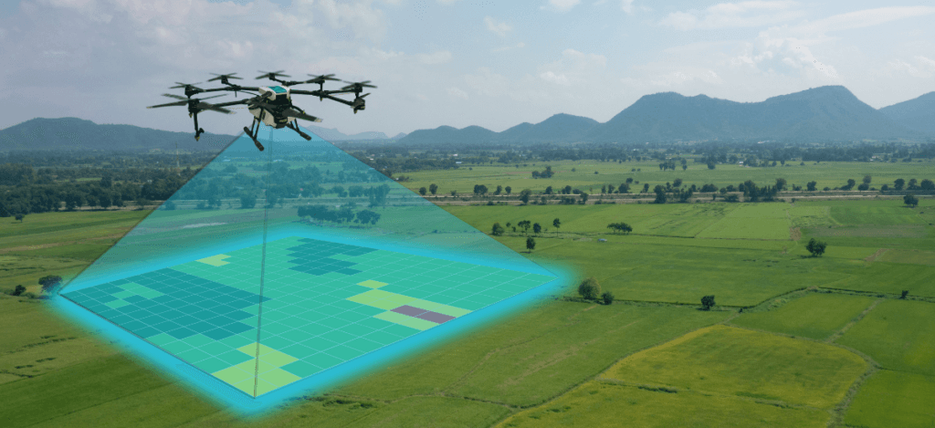
- High Resolution & Detail: Drones fly at lower altitudes than airplanes or satellites, enabling them to capture high-resolution images with much finer details. This is crucial for tasks requiring precise information, such as monitoring endangered species or tracking crop growth.
- Faster & More Frequent Monitoring: Their agility allows for quicker data collection and the possibility of frequent monitoring of a specific area. This is beneficial for tracking rapid changes, like those occurring during a natural disaster or disease outbreak in crops.
- Flexibility & Accessibility: Their maneuverability allows for data collection in previously inaccessible areas or over specific features of interest.
- Real-Time Monitoring: Some drones can transmit data during flight, enabling real-time monitoring for applications like disaster response or environmental monitoring.
Integration with GIS (Geographic Information System) at Geoinfotech:
- Real-Time Analysis & Decision Making: At Geoinfotech, Drones are seamlessly integrated with GIS platforms. Collected data is fed into the GIS system for real-time processing and analysis, aiding in faster decision-making for tasks like resource allocation during emergencies.
Overall Impact:
These advancements in drone technology have made remote sensing:
- More Cost-Effective: Drones offer a cost-effective alternative to traditional methods like manned aircraft.
- More Efficient: Data collection can be done faster and with greater flexibility.
- More Informative: The wider range of sensors and high-resolution data allows for more detailed analysis of the Earth’s surface.
APPLICATION OF DRONE TECHNOLOGY IN REMOTE SENSING AT GEOINFOTECH
Precision Agriculture:
- At Geoinfotech we apply Drone technology to capture high-resolution images of crops to assess their health, identify pest infestations, and track growth patterns. This information allows farmers to apply fertilizers and pesticides more precisely, optimizing resource use and crop yield.
Environmental Monitoring:
- Drones are deployed to monitor deforestation, track changes in water quality, and map the spread of wildfires. They can also be used to study wildlife populations and habitats in remote areas.
Disaster Response:
- Following natural disasters like floods or earthquakes, at Geoinfotech we can provide vital aerial imagery of affected areas. This information helps emergency responders assess the damage, locate survivors, and plan rescue efforts.
Infrastructure Inspection:
- Drones are be used to inspect bridges, pipelines, and other infrastructure for signs of damage or wear and tear at Geoinfotech. This allows for early detection of potential problems, preventing costly repairs and ensuring public safety.
Urban Planning & Development:
- Drones can be used to create 3D models of cities, which can be helpful for urban planning and development projects. They can also be used to monitor construction progress and identify potential safety hazards.
Archaeology:
- Drones can be used to create detailed maps of archaeological sites, revealing features that might be difficult to see from the ground. This helps archaeologists to better understand past civilizations and their settlements.
Mining and Exploration:
- Drones can be used to map and survey mining areas, as well as to identify potential mineral deposits. They can also be used to monitor the environmental impact of mining operations.