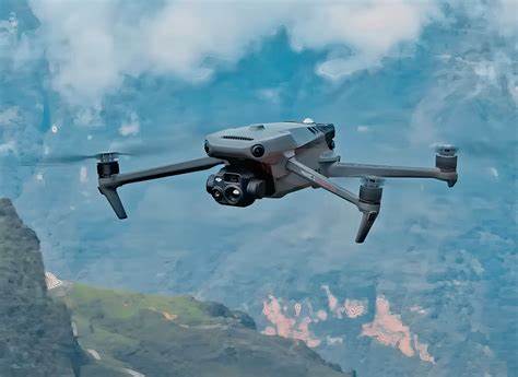
Elevate your drone mapping projects with the DJI Mavic 3 Enterprise, a compact and powerful commercial drone designed for professional surveying, mapping, and inspection.
Priced at ₦6,350,000 at GeoInfoStore.com, this drone combines a high-resolution 4/3 CMOS camera, optional RTK precision, and advanced features to deliver unparalleled efficiency for geospatial professionals. Discover how the Mavic 3 Enterprise can transform your aerial mapping operations.
Why Choose the DJI Mavic 3 Enterprise?
The DJI Mavic 3 Enterprise is built for professionals who demand accuracy and portability in drone mapping. Its advanced imaging system, long flight time, and robust design make it the ideal choice for surveyors, agricultural analysts, and infrastructure inspectors seeking reliable, high-quality data.
Key Features
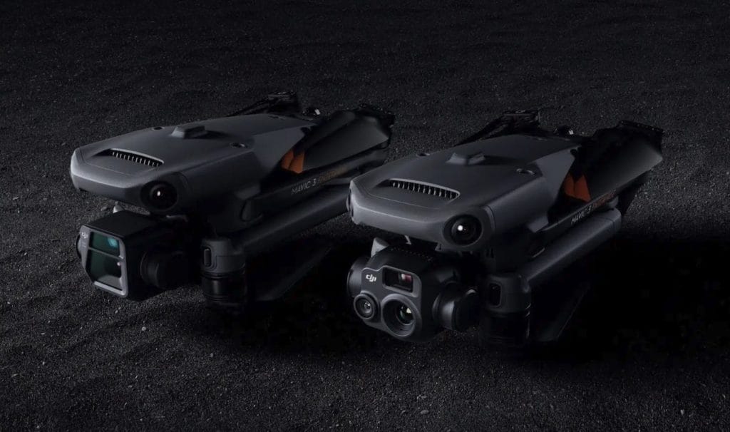
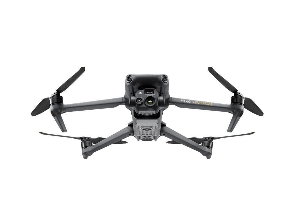
- Dual-Camera System: Features a 4/3 CMOS 20MP wide camera with a mechanical shutter for distortion-free images and a 12MP telephoto camera with 56x hybrid zoom, perfect for detailed photogrammetry and inspections from a distance.
- Optional RTK Module: Achieve centimeter-level accuracy with the RTK module, minimizing the need for ground control points and enhancing compatibility with software like DJI Terra or Pix4D for precise 2D and 3D mapping.
- 45-Minute Max Flight Time: Cover up to 2 square kilometers in a single flight, enabling efficient mapping of large areas with minimal downtime.
- O3 Enterprise Transmission: Provides a 15km transmission range (FCC) with a 1080p/30fps live feed, ensuring stable data transfer during expansive survey missions.
- Omnidirectional Obstacle Avoidance: Wide-angle vision sensors and advanced algorithms ensure safe navigation in complex environments like urban areas or dense forests.
- Compact and Portable: Weighing only 915g, the Mavic 3 Enterprise is easily portable and can be deployed in seconds, ideal for rapid-response mapping tasks.
- Smart Features: Supports automated flight modes like Waypoints and Smart Oblique Capture, streamlining mission planning and data collection for efficient workflows.
What’s Included
- DJI Mavic 3 Enterprise Drone (1)
- Remote Controller (1)
- Intelligent Flight Batteries (2)
- Charging Hub & Cables
- Propeller Sets (2)
- Carrying Case (1)
- User Manual & Warranty Documents
Ideal Applications for Drone Mapping
The DJI Mavic 3 Enterprise excels in a variety of professional mapping scenarios:
- Land Surveying: Create high-accuracy 2D orthomosaics and 3D models for urban planning, topographic surveys, or real estate development, enhanced by RTK precision.
- Agriculture: Map fields to monitor crop health, assess irrigation needs, or plan resource allocation, using high-resolution imagery for detailed analysis.
- Infrastructure Inspection: Conduct detailed inspections of bridges, powerlines, or pipelines with the 56x zoom, reducing risks and costs compared to manual methods.
- Environmental Monitoring: Survey forests, wetlands, or coastlines to track environmental changes or support conservation efforts with precise geospatial data.
DJI Mavic 3 Enterprise Price in Nigeria
Price: ₦6,350,000
Available at GeoInfoStore.com
Contact Us
Ready to revolutionize your drone mapping operations with the DJI Mavic 3 Enterprise? Contact our team to schedule a demo or place your order today:
- Phone/WhatsApp: +234 816 322 2177 or +234 813 410 1202
- Website: Geostore
As an authorized DJI Enterprise dealer, we offer local repairs, training, and after-sales support, along with fast nationwide shipping and drone compliance assistance.
Why Buy from GeoInfoStore?
- Authorized DJI Enterprise Dealer in Nigeria
- Local repairs, training & after-sales support
- Fast nationwide shipping
- Drone compliance & operational setup assistance
GeoInfoStore is Nigeria’s top drone equipment provider for industrial, commercial, and government use.