Redefine Aerial Surveying with the DJI Zenmuse P1: Now Available in Nigeria for ₦8,111,000
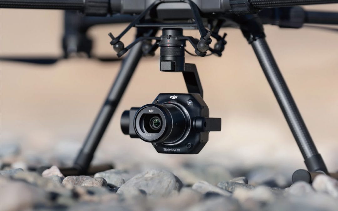
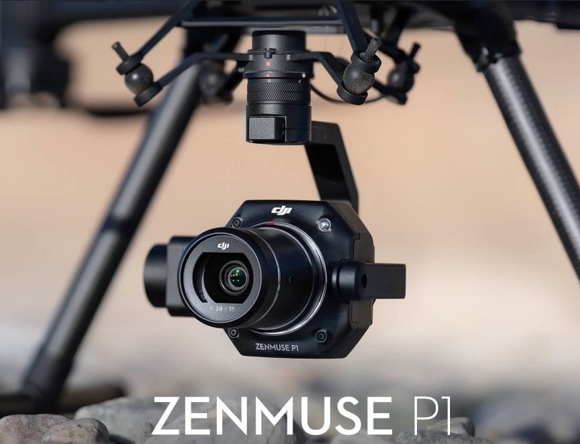
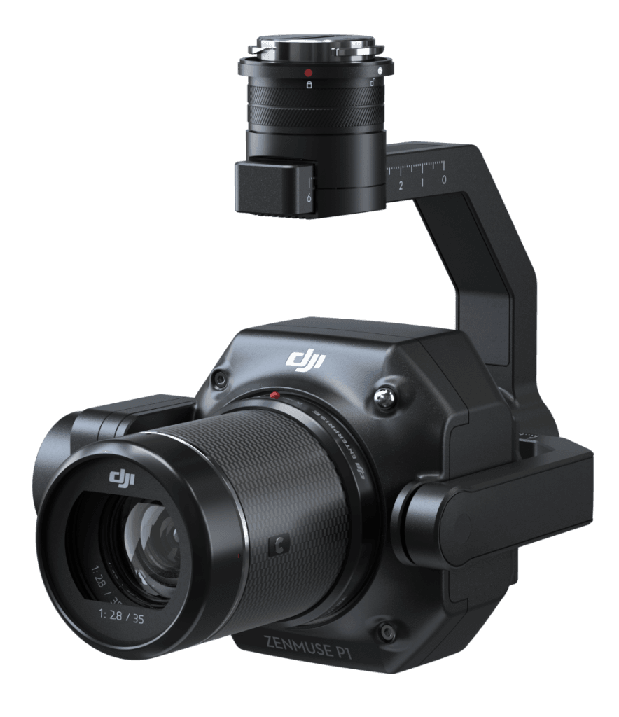
Nigeria’s geospatial, construction, and environmental sectors require precision and speed in aerial data collection. The DJI Zenmuse P1, priced at ₦8,111,000, is a revolutionary photogrammetry payload for the DJI Matrice 300/350 RTK, featuring a full-frame sensor and interchangeable lenses. Designed for high-efficiency mapping missions, the P1 delivers centimeter-level accuracy, transforming surveying and modeling workflows across Nigeria.
Unmatched Photogrammetry Performance
The Zenmuse P1 sets a new benchmark for aerial surveying with its advanced imaging system:
- 45MP Full-Frame CMOS Sensor: With a 4.4μm pixel size, it captures ultra-detailed imagery, even in low-light conditions, extending operational hours.
- Interchangeable DJI DL Lenses (24/35/50mm): Tailor your field of view (FOV) for diverse applications, from wide-area mapping to detailed inspections.
- Global Mechanical Shutter: Achieves 1/2000s shutter speed, eliminating motion blur for crisp images during high-speed flights.
- TimeSync 2.0: Synchronizes camera, gimbal, flight controller, and RTK module at the microsecond level, ensuring precise geotagging.
With 3cm horizontal and 5cm vertical accuracy without ground control points (GCPs), the P1 delivers reliable results for mission-critical tasks.
Tailored for Nigeria’s Mapping Needs
The Zenmuse P1 excels in Nigeria’s diverse industries:
- Land Surveying and Cadastral Mapping: Map expansive regions like Kano or Oyo with efficiency, covering up to 3 km² in a single flight at 3cm GSD, ideal for boundary delineation and land management.
- Urban Planning: Generate detailed 2D orthomosaics and 3D models for cities like Lagos or Abuja, supporting infrastructure development and zoning.
- Environmental Monitoring: Track ecosystem changes in Nigeria’s forests or wetlands, such as Okomu or Niger Delta, with high-resolution data for conservation efforts.
- Flood Risk Assessment: Create accurate digital elevation models (DEMs) for flood-prone areas like Mokwa, enhancing disaster preparedness.
With a 3-axis stabilized gimbal and Smart Oblique Capture, the P1 optimizes image collection, reducing post-processing time by 20–50% while covering up to 7.5 km² in a workday.
Streamlined Workflow and Efficiency
The P1 enhances productivity with intelligent features:
- Rapid Image Capture: Takes a photo every 0.7 seconds, maximizing data collection speed.
- DJI Terra Integration: One-click processing creates 2D maps, 3D models, and DEMs, with automated mission data management.
- Real-Time Monitoring: DJI Pilot 2 displays live mission progress, ensuring complete coverage.
- Robust Design: Operates in Nigeria’s varied climates, from humid coastlines to arid interiors.
Invest in Precision Mapping
At ₦8,111,000, the Zenmuse P1 is a cost-effective solution for Nigerian professionals seeking to elevate their surveying capabilities. Paired with the Matrice 300/350 RTK, it delivers rapid returns through enhanced accuracy and efficiency.
Order Yours Today
Ready to transform your aerial surveying?